


Meteorologist April Loveland's First Warning Forecast
A picture-perfect weekend on tap.
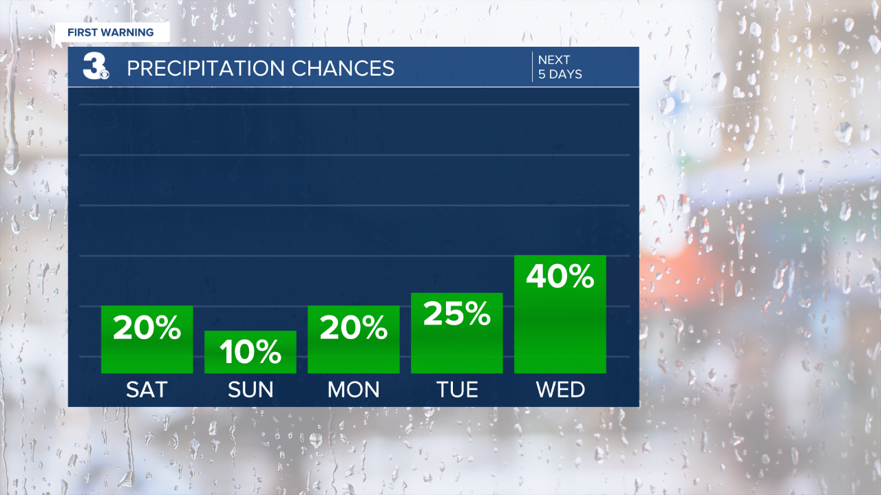
After days of heat, humidity and storms, we're finally getting a break! High pressure will build in today which will help to clear away the clouds as the day progresses. Highs will warm to the low 80s with lower humidity.
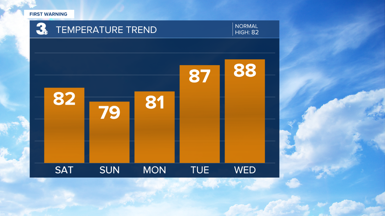
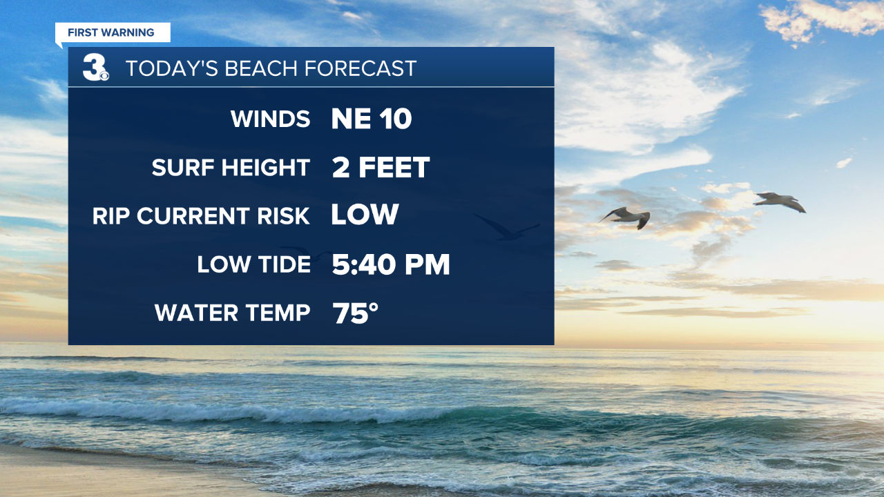
Another comfortable day Sunday. It will be a bit breezy with highs in the upper 70s. Potential Tropical Cyclone One will be well off the Carolina coast, but we will still have to deal with some rough surf and rip currents. Conditions are still looking dry.
More sunshine will break out to kick off the work week. Highs will warm to the low 80s.
The humidity starts to creep up on Tuesday. Keeping a slight 25 percent chance for a spotty shower or storm by the afternoon. Otherwise, warmer with highs in the mid and upper 80s.
Better chances for showers and storms by Wednesday. Expect highs in the upper 80s.
Very humid on Thursday with highs in the mid and upper 80s. Showers and storms will be possible.
Looks like we'll dry out by Friday with highs in the mid 80s under partly cloudy skies.
Tropical Update:
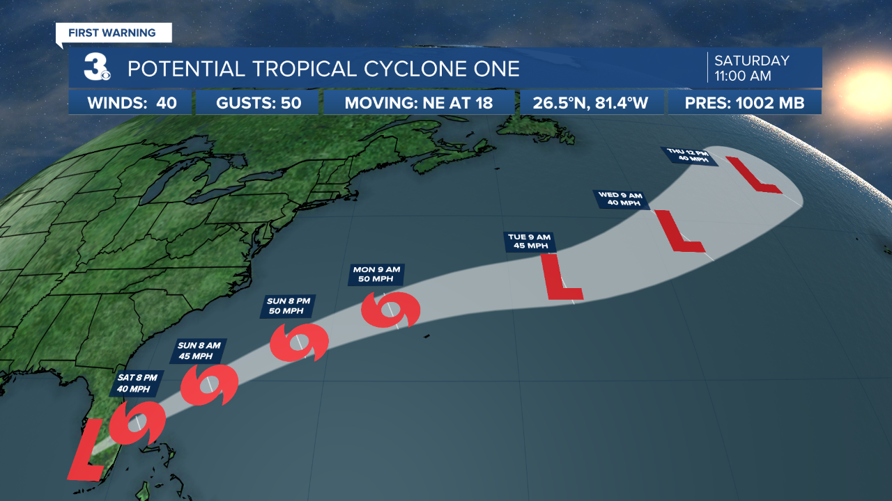
The system is moving toward the northeast near 18 mph, and this general motion is expected to continue through tonight. A turn toward the east-northeast with an additional increase in forward speed is expected on Sunday, followed by a turn toward the east Monday night.
On the forecast track, the disturbance is expected to move across southern or central Florida today, over the southwestern Atlantic north of the Bahamas tonight, and near or to the north of Bermuda on Monday.
Maximum sustained winds are near 40 mph with higher gusts.
The disturbance is expected to become a tropical storm off the east coast of Florida by tonight, and some strengthening is forecast tonight through Monday as the system moves farther away from Florida over the western Atlantic.
* Formation chance through 2 days: HIGH (90%)
* Formation chance through 5 days: HIGH (90%)
Once it strengthens, it will be named Alex.
Impacts to us? Rough surf and rip currents starting tomorrow through Tuesday.
Meteorologist April Loveland
For weather updates on Facebook: HERE
Follow me on Twitter: HERE
Follow me on Instagram HERE
Check out the Interactive Radar on WTKR.com: Interactive Radar
