


Meteorologist April Loveland's First Warning Forecast
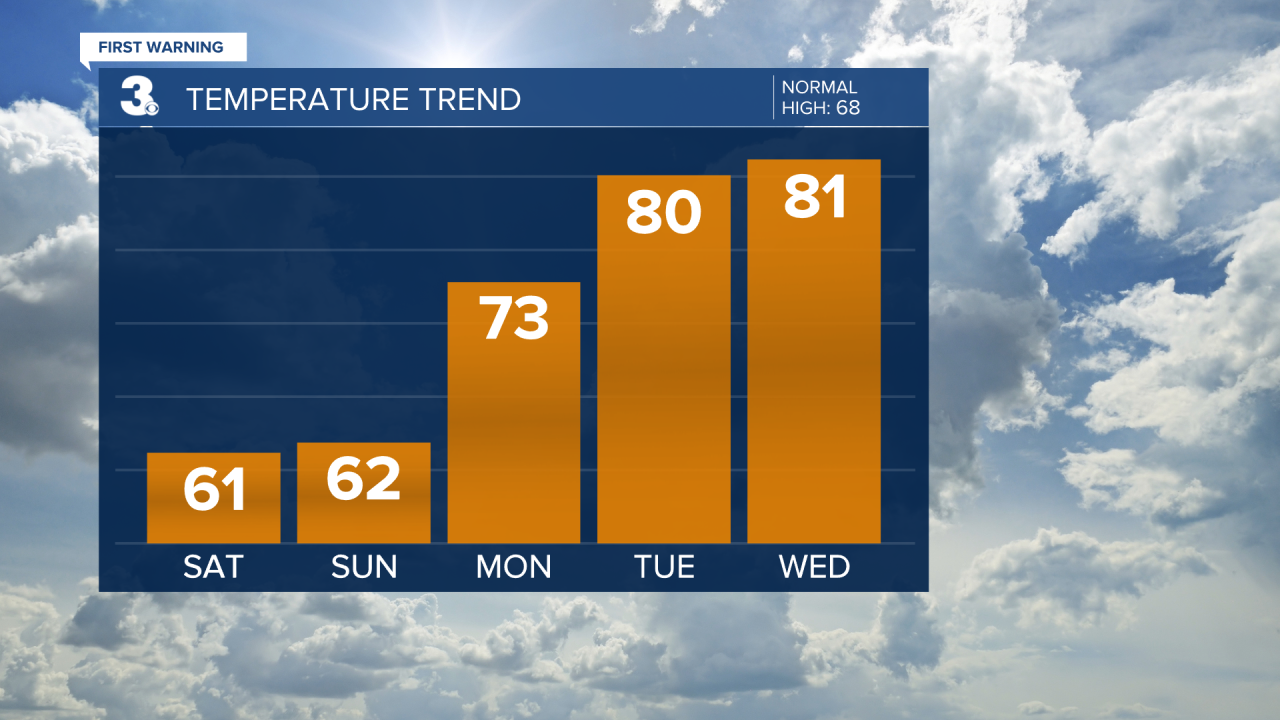
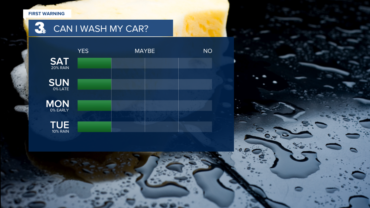
Clouds will break up as the day progresses. Temperatures will be a bit cooler today with highs in the upper 50s and low 60s. It will be a bit breezy with winds out of the west at 10-15 mph, with gusts up to 25 mph.
High pressure will build in on Sunday allowing for more sunshine to break out. Expect partly sunny skies with highs in the low 60s. It will once again be a bit on the breezy side.
A warming trend kicks off on Monday. Highs will soar to the low 70s under partly cloudy skies. Conditions are looking dry.
High pressure will remain in control for most of the week. Tuesday will be even warmer with highs near 80. Wednesday will feature a nice mix of sun and clouds with highs in the low 80s.
A cold front is set to move in by Thursday and Friday. Right now, models are not agreeing, but keeping a slight chance for a few showers late Thursday. Otherwise, the day will be breezy and warm with highs in the low 80s. Scattered showers and storms will be possible to end the work week. Temperatures will fall into the mid 70s.
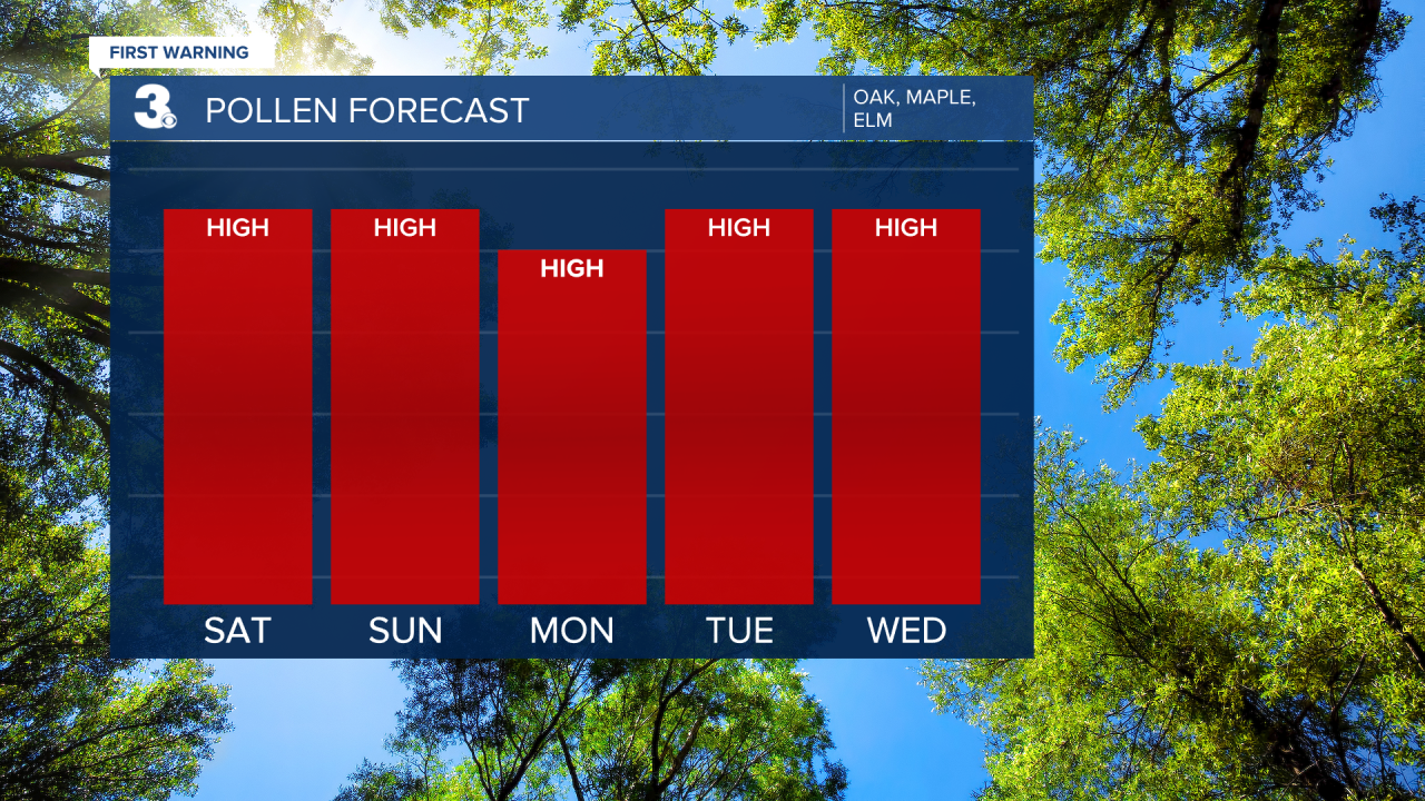
Check out the Pollen Forecast:
Meteorologist April Loveland
For weather updates on Facebook: HERE
Follow me on Twitter: HERE
Follow me on Instagram HERE
Check out the Interactive Radar on WTKR.com: Interactive Radar
