


Meteorologist Kristy Steward's First Warning Forecast
Good Thursday night! Our severe threat is now over! We had an active afternoon and evening with 2 tornado warnings and 8 severe thunderstorm warnings covering the leading edge of this storm system that swept across the region. We had some storm damage reports of large golf ball sized hail, trees down, power outages and even a mobile home blown over in Bertie county. Some of this storm damage will likely be reviewed by the National Weather Service tomorrow to see if a tornado did indeed cause that structural damage.

Now that the storms are out of here, we're drying out and clouds will eventually break apart. Temperatures tonight cool into the low 50s. Drier and cooler Friday. Some isolated showers will likely pass through in the afternoon. Highs in the mid 60s.

This weekend will be dry, a bit breezy, cooler and feature a mix of sun and clouds. Highs both Saturday and Sunday in the low 60s. Some locations may not make it out of the 50s.
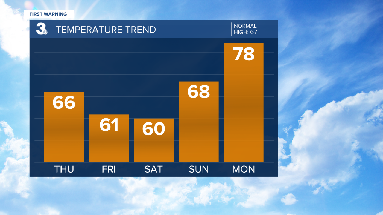
Next week starts off dry with a mix of sun and clouds. We also hop on a warming trend next week. We start the workweek Monday in the upper 60s, jumping to the upper 70s Tuesday, and low 80s for Wednesday and Thursday. Overnight lows will also warm from the 40s to the mid 60s. A few showers will be possible Thursday ahead of an approaching cold front.
Connect with Meteorologist Kristy Steward:
