


Meteorologist Kristy Steward's First Warning Forecast
Happy Friday night! We had a couple rounds of storms today that cleared out around sunset. Now we're moving into a drier, cooler pattern.
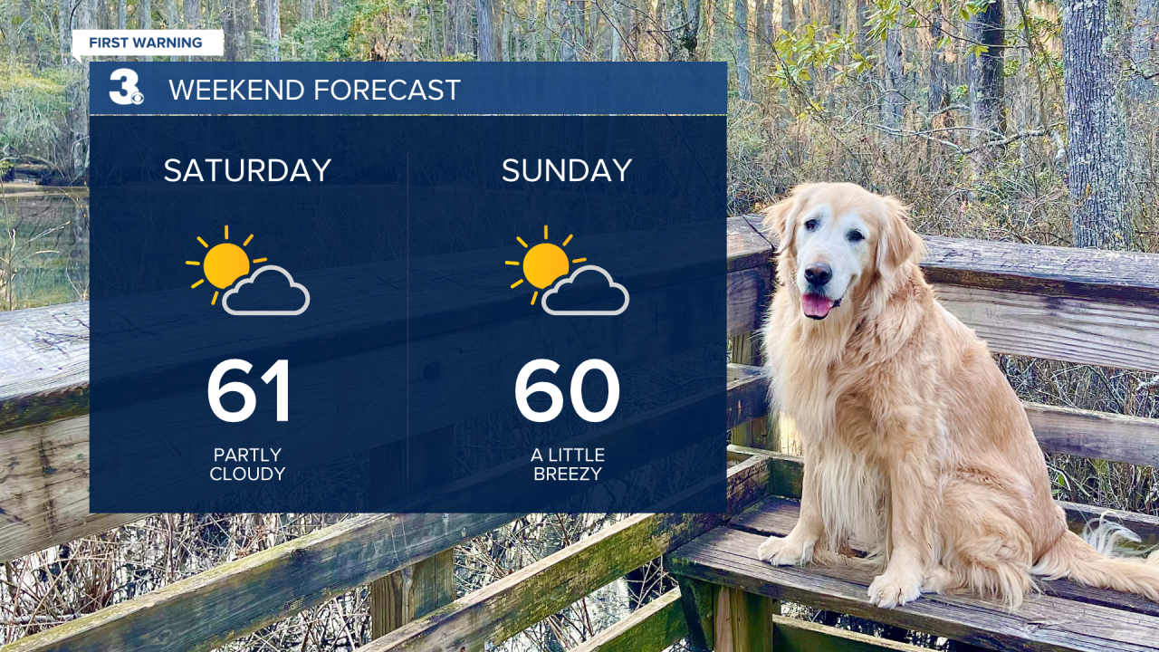
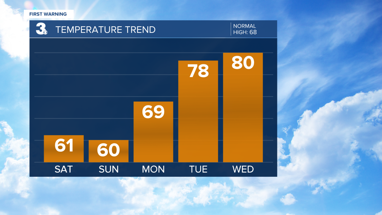
A series of disturbances passing through this weekend is what brought us widely scattered storms this afternoon. The rest of the disturbances will be weaker. Expect mostly dry and breezy conditions Saturday and Sunday. Both days will also be cooler with highs in the upper 50s to low 60s and overnight lows in the low 40s. A few stray showers are possible Saturday, but majority will stay dry.
We stay dry heading into the workweek. The first half of the week we'll have a mix of sun and clouds. Temperatures take a big leap into the upper 60s Monday, then the upper 70s Tuesday and low 80s by Wednesday. A cold front headed our way at the end of the week could bring isolated to widely scattered rain showers Thursday into Friday. Friday we start to cool a little. Only down to the mid 70s though.
Connect with Meteorologist Kristy Steward:
