


Meteorologist Kristy Steward's First Warning Forecast
Happy Sunday night! Today was much warmer with highs in the upper 60s to low 70s. Hopefully you enjoyed it because cooler air is heading our way Monday. Fortunately, it will be a short-lived dip in temperatures.
A developing cold front passes through tonight. It'll still be relatively weak as it's in the process of developing, so we'll stay with a clear sky all night. Winds will become breezier though. Northwesterly winds of 10-20 MPH. Temperatures will also get cooler. Overnight lows drop into the upper 30s to low 40s.
Monday will be a cooler day. Highs in the upper 50s to low 60s. Ahead of an unsettled pattern, clouds will begin to increase Monday afternoon and evening. We'll get a reprieve in winds Monday, just the typical lighter 5-10 MPH winds. Winds pick up again for the rest of the week while we are in our unsettled pattern.

A warm front moves just to our north late Monday before stalling out. We'll stay in an unsettled pattern until Thursday. Then a low pressure system develops along the stationary front and strengthens, pushing this system out of Hampton Roads late Thursday. Behind it, a couple disturbances follow Friday and Saturday. Throughout this unsettled pattern, we'll be warm, windy and wet.

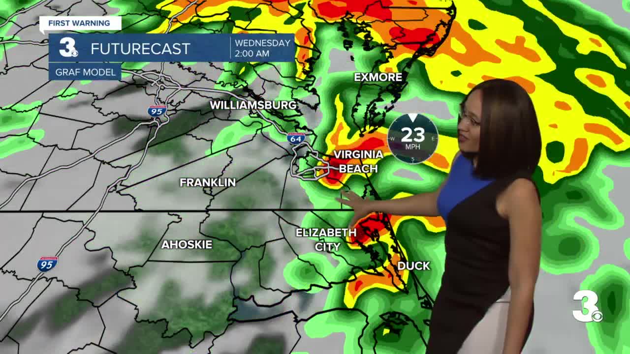
Expect spotty to isolated showers throughout the day Tuesday. Most areas should remain mostly dry until the evening hours. The widespread rain and possible storms will roll in around 8 PM Tuesday and continue through the night into early Wednesday morning. The widespread rain looks to be out of here before sunrise Wednesday, then early Wednesday morning during the morning commute, lingering isolated showers will be possible. Most of the day Wednesday looks dry. Then with that developing low pressure system Thursday, we'll see more scattered storms. Some of these storms could become strong to severe. Already 5 days out, the Storm Prediction Center has us in a highlighted area to watch. Usually, that will translate to at least a Level 2 severe threat. Something to keep an eye on the next several days.

With the lingering disturbances passing through Friday and Saturday, stray to isolated showers are possible, but we will be drier those days. Temperatures go from the mid 70s Tuesday - Thursday to the mid 60s Friday.
Next weekend will be drier with more sun, but also cooler. High temperatures in the low 60s both Saturday and Sunday.
Connect with Meteorologist Kristy Steward:
