


Meteorologist Kristy Steward's First Warning Forecast
Happy Friday evening! That backdoor cold front really knocked temperatures down quickly this afternoon! At one point we had a temperature range from the mid 50s to low 90s. Temperatures stay cooler this weekend and our rain chances increase. Next week, we’ll be closer to a summertime pattern.
Tonight stays mostly dry with a lot of cloud cover. Similar weather continues throughout Saturday. High temperatures in the low 70s. Saturday evening, we could have isolated to scattered showers pass through our inland communities.
Spotty showers are possible Saturday night and Sunday morning, but again, most look to stay dry. Sunday afternoon and evening is when a round of scattered showers and storms moves from the west to the east. Likely reaching Southside around 4 PM, so if you’re going to the Wine Fest in Norfolk, most of the event looks dry.
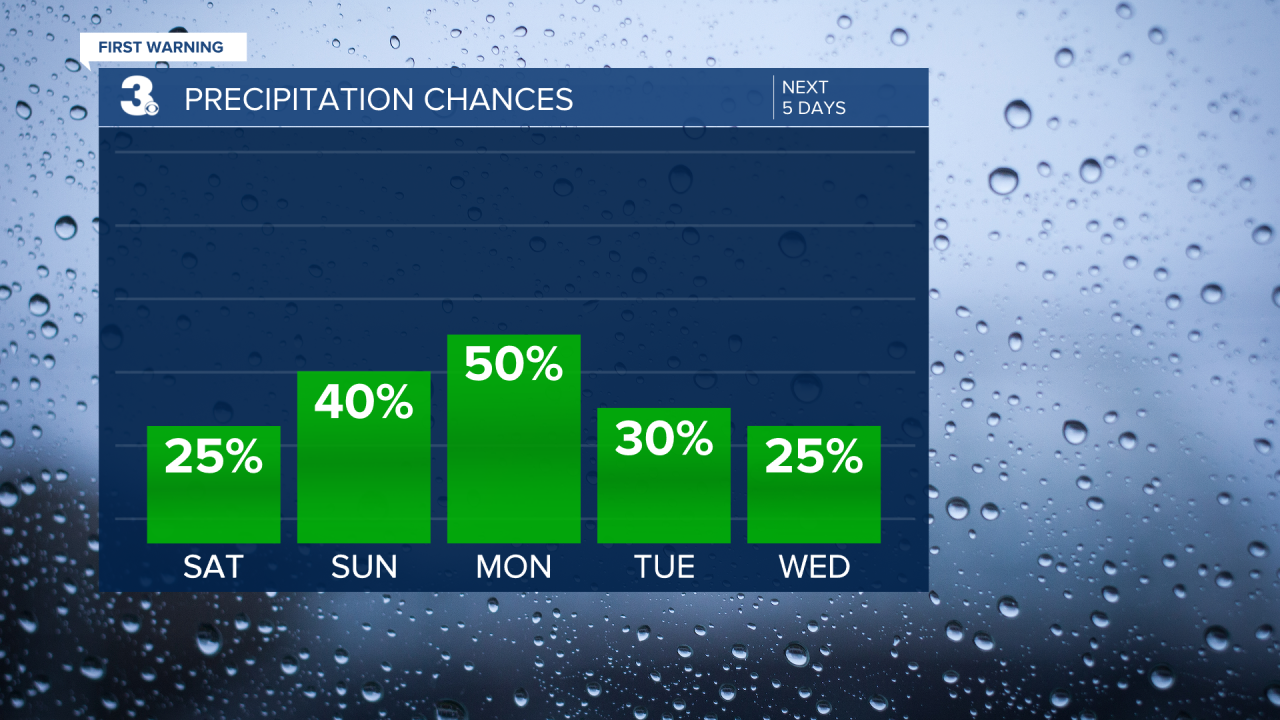
From the second half of Sunday through next week, you’ll want to have some rain gear on hand. We have daily chances for isolated to scattered showers and storms.
Temperatures will be on quite the warming trend starting Sunday. Highs on Sunday in the upper 70s reach the mid 80s Tuesday and likely hit 90° Wednesday and Thursday. Then, a cold front cools us down to about 80° Friday.

Connect with Meteorologist Kristy Steward:
FACEBOOK
X
INSTAGRAM
