


Meteorologist Kristy Steward's First Warning Forecast
Happy Friday night! We are still on this roller coaster ride of unsettled weather and will stay on it through this weekend.
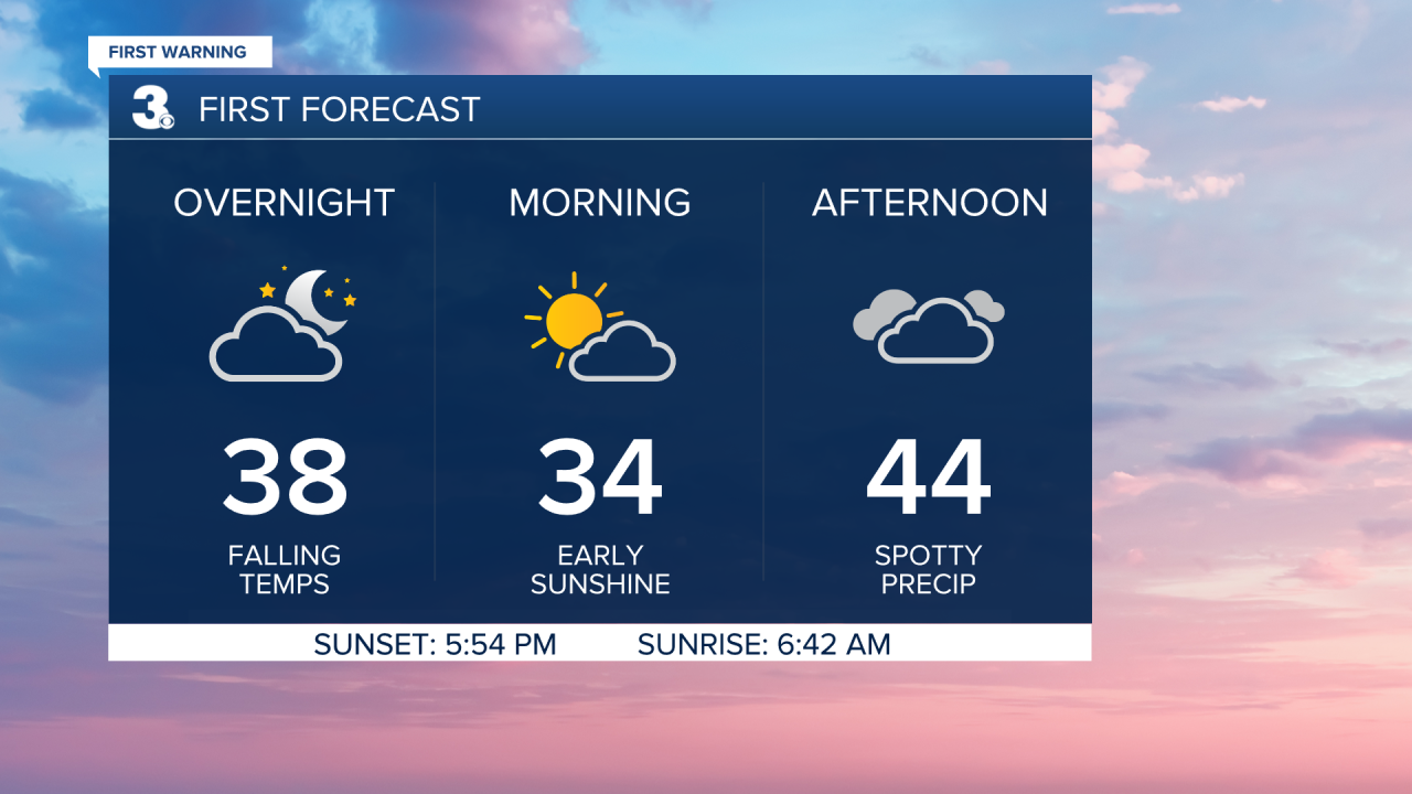
A cold front has just passed through. Tonight we’ll notice northerly winds picking up to 10-20 MPH behind it. We’ll also notice a temperature drop. Temperatures when we wake up Saturday morning will be in the mid 30s, feeling like the mid 20s.
Saturday stays mostly cloudy, mostly dry, and chilly. Highs in the mid 40s. A disturbance on the backside of this system could bring us a few sprinkles, flurries, and even sleet pellets mixed in midday. Just a few very isolated showers are possible Saturday, most areas should stay dry.
Sunday gets a bit warmer ahead of another cold front. Highs in the low to mid 50s. Scattered rain showers throughout Sunday morning taper off by Sunday afternoon and clouds clear out Sunday evening once high pressure starts to move in.
High pressure will bring us lots of sunshine Monday, but in the wake of a cold front, Monday will be cold. Highs in the low 40s.
The first week of March will be dry with a mix of sun and clouds. We also start on a warming trend that keeps us with near-to-above-normal temperatures. Highs peak in the mid 60s Thursday. Canadian high pressure cools us down to the seasonable mid 50s Friday, but also brings us a sun-filled sky.

Connect with Meteorologist Kristy Steward:
