


Meteorologist April Loveland's First Warning Forecast
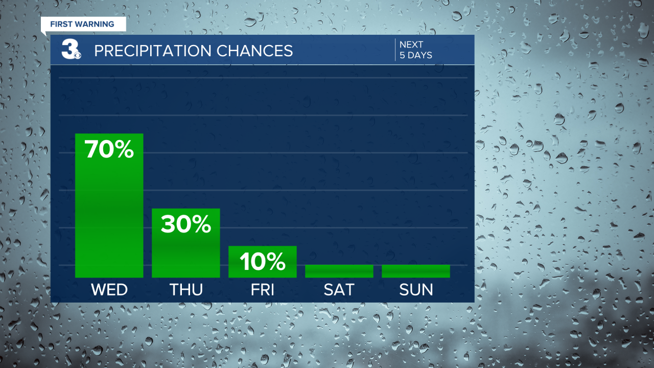
A strong cold front will move in on Wednesday. The entire area is under a Level 2 for severe storms. The biggest threat will be damaging wind gusts, large hail, and isolated tornadoes. Showers and storms will move in during the morning hours and then again by late afternoon/evening.
Temperatures will warm to the mid 70s.


The cold front will not only bring wet weather, but will bring a big drop in temperatures.

Once we get past Wednesday, temperatures will trend in the 50s, which is below normal for this time of year. The weather is looking dry and breezy with partly to mostly sunny skies.
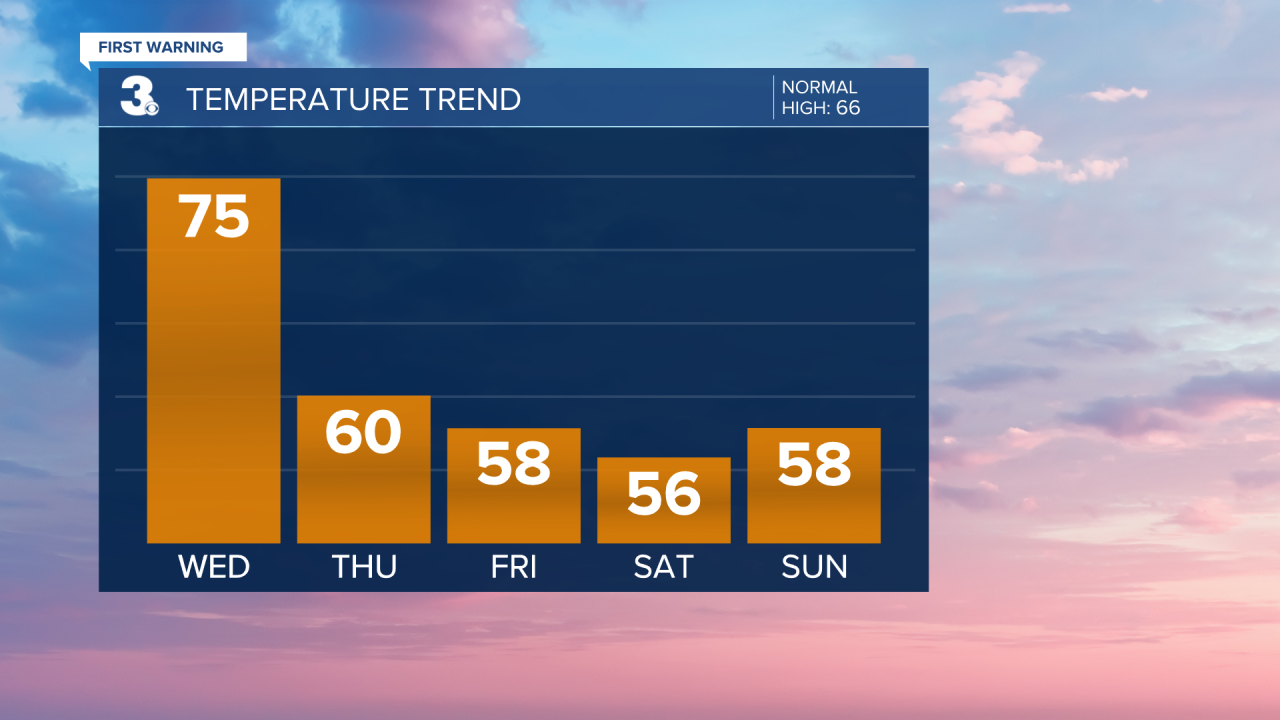
The weekend is looking dry and cool with highs in the 50s.
Meteorologist April Loveland
For weather updates on Facebook: HERE
Follow me on Twitter: HERE
Follow me on Instagram HERE
Check out the Interactive Radar on WTKR.com: Interactive Radar
