


Meteorologist Kristy Steward's First Warning Forecast
Happy Sunday night! We had a rough line of storms roll through this afternoon. Now that rain has ended, but we have several storm chances next week. Heat and humidity will also be soaring.
Tonight, we could have a stray shower or two, but most areas will remain dry. Partly cloudy and warm with lows in the low 70s.
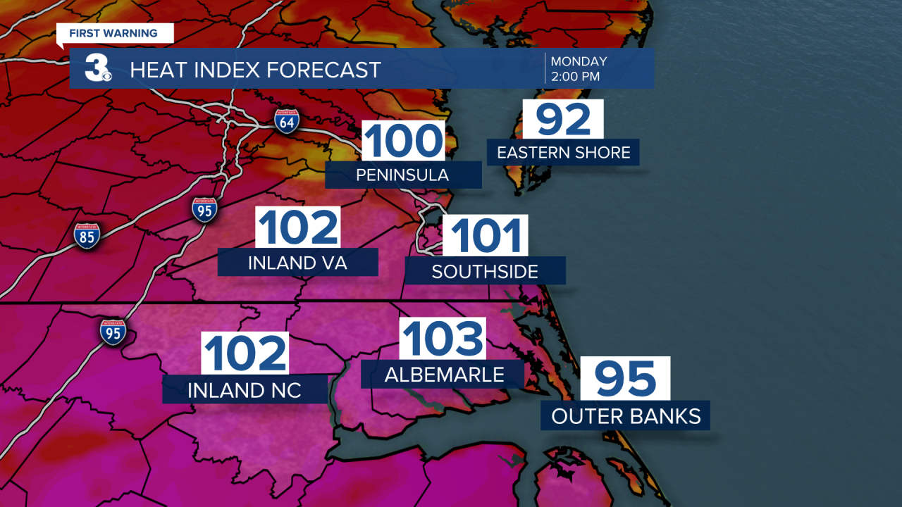
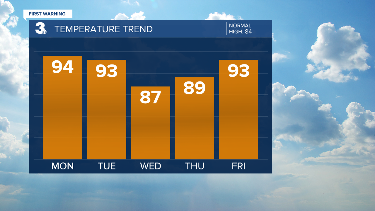
The heat is on Monday! Highs in the mid 90s feeling like 100-105°. Stay cool and hydrated! With this high heat and humidity, we’ll likely see isolated storms pop-up in the afternoon.
Tuesday will be almost as hot. Just a degree or two cooler. We’ll also have a round of scattered storms. These storms look to be strong and could possibly become severe. We’re all already under a level 1 of 5 risk for severe storms Tuesday. The timing is a bit up in the air, but likely Tuesday afternoon and evening just ahead of a cold front. Damaging winds are the main threat.

The middle of next week will be a bit nicer. Still hot with highs in the upper 80s, but mostly dry with plenty of sunshine.
High heat returns Friday following a warm front and ahead of a cold front. High temperatures return to the low to mid 90s. We’ll get breezy Friday and see scattered storms. That activity will set us up for a gorgeous weekend!
Right behind the cold front, Canadian high pressure will start to move in. That will bring us tons of sunshine, keep us dry with low humidity and cooler temperatures. Expect highs both Saturday and Sunday to be in the low 80s.
Connect with Meteorologist Kristy Steward:
