


Meteorologist April Loveland's First Warning Forecast
Our next weather maker moves in today with rain spreading across the area for most of the day. Rain will exit the area by midnight. Highs will warm to the low 40s.
Drying out on Tuesday with partial clearing as the day progresses. Highs will warm to the upper 40s.
We'll enter a quiet weather pattern for the rest of the week. Temperatures will continue to gradually warm as the week progresses. The normal high in Norfolk is now 52 degrees.
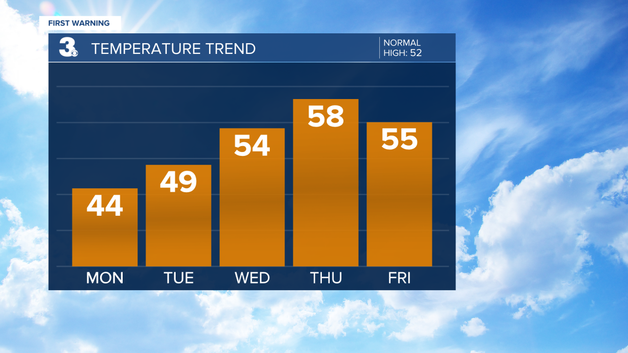
Expect dry conditions, sunshine and highs in the low 50s on Wednesday.
We'll then warm to the upper 50s on Thursday and then back to the mid 50s on Friday.
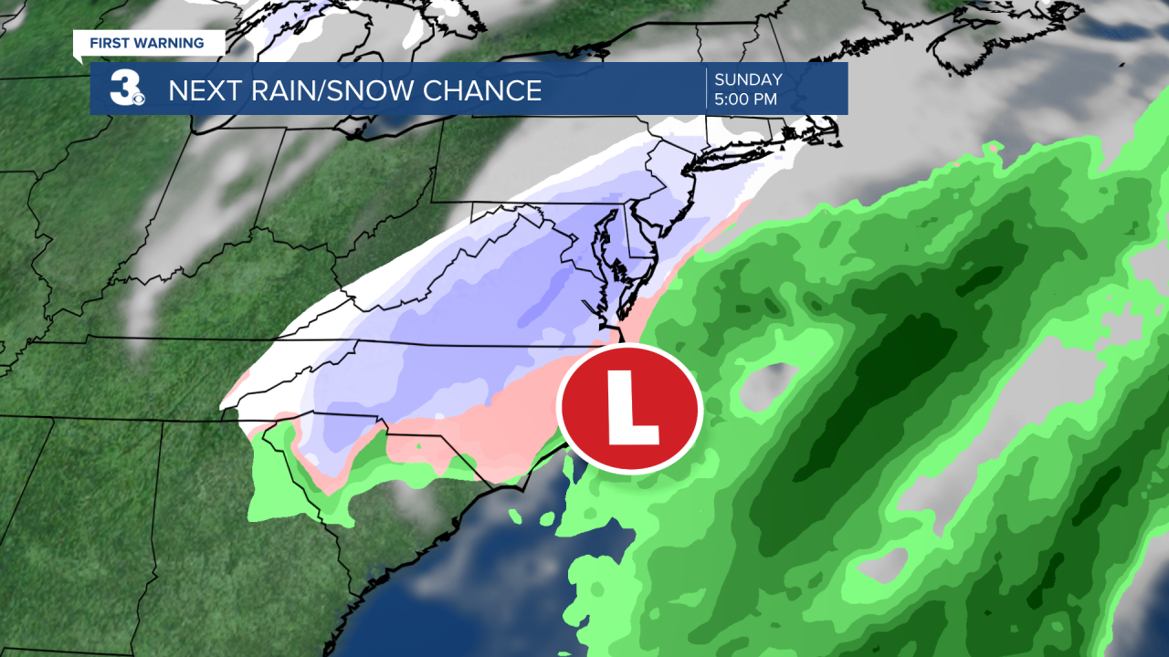
The weekend will be 50/50. Saturday will feature sunshine and highs in the upper 50s. Our attention turns to the next weather maker on Sunday. This system could bring us the chance for rain and snow. Still too early to tell, but STAY TUNED!
Meteorologist April Loveland
For weather updates on Facebook: HERE
Follow me on Twitter: HERE
Follow me on Instagram HERE
Check out the Interactive Radar on WTKR.com: Interactive Radar
