


Meteorologist Kristy Steward's First Warning Forecast
Good Saturday night! Hopefully you stepped outside and enjoyed the gorgeous weather we had today! By the time you wake up Sunday morning, you'll be transported back to Winter.
Clouds increase around a cold front that slowly passes through tonight. This front will bring us breezy northerly winds of 10-20 MPH and gradually dropping temperatures. Our warmest temperatures Sunday will be when you wake up, in the low 40s. Temperatures gradually drop throughout the entire day, reaching the mid 30s by Sunday afternoon, but feeling like the mid 20s. That's when we'll see our rain transition over to snow. Expect scattered snow showers to start late Sunday afternoon around 5 PM and taper off Sunday night after Midnight.
By the end of this event, most will see a dusting mainly on grassy and elevated surfaces. The Eastern Shore could potentially see up to 1" accumulation. Being so warm these past few days has increased our road temperatures and it will take roads longer to reach below freezing. So most of the snow that falls on this warmer pavement will melt on contact. However, anything wet on the pavement overnight is expected to freeze as temperatures drop into the mid 20s. Watch for a few slick spots when leaving your Super Bowl party location and as you head to work Monday morning.

Some lingering flurries are possible Monday morning, but they won't amount to anything. Valentine's Day is going to be quite chilly with highs in the upper 30s. We'll also get to enjoy some sunshine.
High pressure briefly hangs out over Hampton Roads Tuesday then leaves Wednesday. It will help put us on a warming trend and bring us lots of sunshine Tuesday. Highs in the mid to upper 40s Tuesday rise to the low 60s Wednesday and even 70° Thursday.
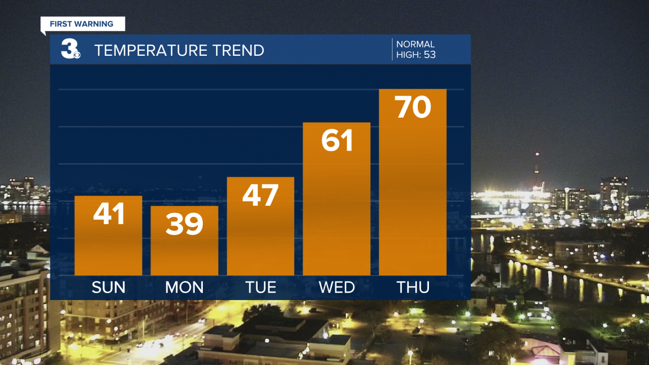
A cold front expected to pass through Friday morning will bring us scattered rain showers later Thursday into Friday. It will also bring cooler temperatures in the 50s to end the workweek and kick off next weekend.
Connect with Meteorologist Kristy Steward:
FACEBOOK
TWITTER
INSTAGRAM
