


Meteorologist April Loveland's First Warning Forecast

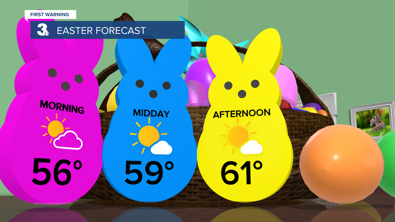
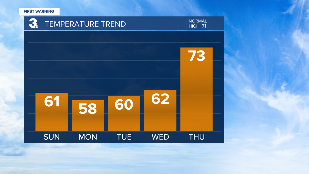
Easter Sunday will feature clearing skies with below-normal temperatures. Temperatures will warm to the low 60s which is 10 degrees cooler than normal and 10 degrees cooler than Saturday.
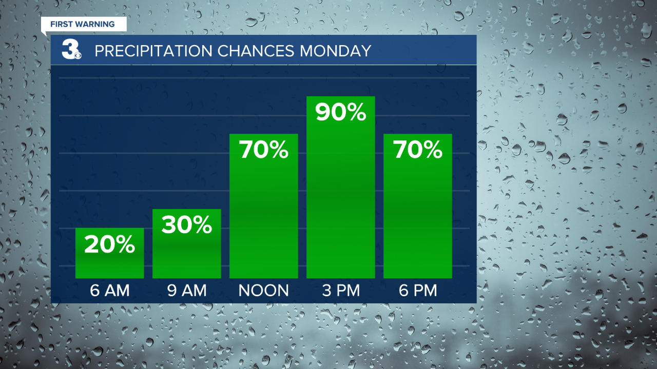
An area of low pressure will move in on Monday. It will be a chilly and messy day with highs in the upper 50s with rain and wind.

Here's the timeline of when we can expect the wet weather to roll in.
Skies will clear on Tuesday. It will be breezy with winds out of the northwest at 15-20, with higher gusts. Temperatures will warm right around 60 degrees.
Lots of sunshine by Wednesday with highs in the low 60s.
Temperatures will finally start trending warmer on Thursday. Expect skies to be partly cloudy with highs in the low 70s. Even warmer on Friday with highs in the mid 70s under mostly sunny skies. The warming trend will continue into Saturday with highs in the mid 70s.
Meteorologist April Loveland
For weather updates on Facebook: HERE
Follow me on Twitter: HERE
Follow me on Instagram HERE
Check out the Interactive Radar on WTKR.com: Interactive Radar
