


Meteorologist Kristy Steward's First Warning Forecast
Good Sunday night! What a soggy day we’ve had with light scattered rain showers all day. Soon, the rain will come to an end and the sunshine will return. That sun will also lead to climbing temperatures.
Scattered light to moderate rain showers continue through the night. Temperatures will drop just a couple more degrees around the mid 60s.
Monday looks to be mostly dry. A few spotty showers, more likely for the Outer Banks throughout Monday. Most of us look to stay dry though and we’ll see some sunshine outside. High temperatures will be pleasant and warmer in the lower 80s.
We stay dry Tuesday with plenty of sunshine, but it will be hot! Highs climb into the low to mid 90s again.
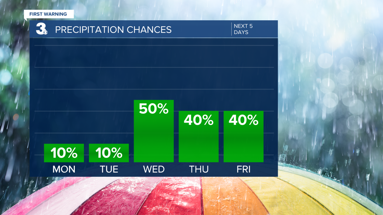
An approaching cold front brings a return of scattered showers and storms Wednesday afternoon and evening. That front will cool us down to the mid 80s for the rest of the workweek and into the weekend. After the front passes, it stalls to our south, keeping us with daily storm chances through the weekend. It’s looking like scattered activity Thursday and Friday, especially in the PM hours, and more isolated activity for the weekend.
Connect with Meteorologist Kristy Steward:
FACEBOOK
TWITTER
INSTAGRAM
