


Meteorologist Kristy Steward's First Warning Forecast
Happy Sunday evening! We continue to dry out tonight and will get to stay dry through much of the workweek. Temperatures will still be on a roller coaster ride, but mostly staying below-normal this week.
Rain showers end early tonight and we could see some breaks in the clouds. Overnight lows drop to the mid 40s.
Monday will be a mostly dry day. A few lingering morning sprinkles can’t be ruled out across northeastern North Carolina. Clouds clear later in the day. High temperatures remain cool in the upper 50s.
There will be a lot of sunshine the rest of the workweek. Temperatures warm to the upper 60s Tuesday.
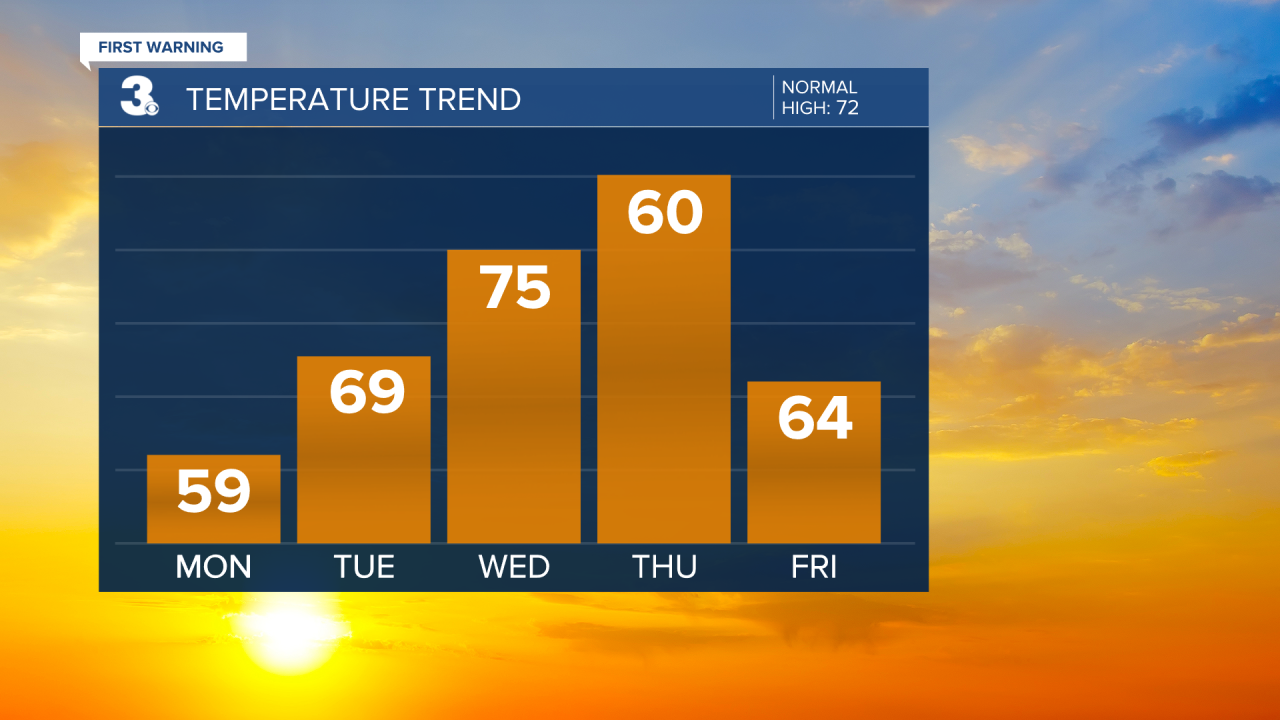
Ahead of a cold front Wednesday, temperatures reach the mid 70s. Around the cold front, midday, we could have some spotty to isolated showers. Winds will also pick up. Behind the front, the end of the workweek will be cooler. Highs around 60° Thursday and in the mid 60s Friday.

Next weekend, a warm front moves through Saturday evening. Around it, we could have spotty to isolated rain showers later Saturday into Sunday morning. Temperatures will be on the rise again. Highs around 70° Saturday look to rise into the mid 70s Sunday.
Connect with Meteorologist Kristy Steward:
FACEBOOK
X
INSTAGRAM
