


Meteorologist April Loveland's First Warning Forecast
We are tracking warming temperatures and increasing rain chances through the end of the week.
High pressure will keep things dry through Thursday. We will however, have to deal with more clouds than sunshine through the week.
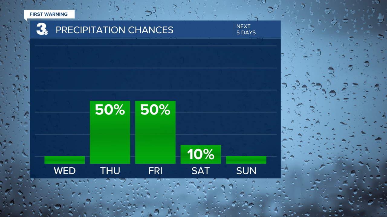
Rain chances will increase late Thursday and carry into Friday morning. Even though we're tracking wet weather on Thursday, high temperatures will soar to the low 60s! It will still be mild on Friday with highs in the upper 50s.

The cold front that will bring us rain on Thursday and Friday, will bring a big drop in temperatures by the weekend. Highs will only warm into the 40s. As of now, the weekend is looking dry, but chilly.

Meteorologist April Loveland
For weather updates on Facebook: HERE
Follow me on Twitter: HERE
Follow me on Instagram HERE
Check out the Interactive Radar on WTKR.com: Interactive Radar
