


Meteorologist Kristy Steward's First Warning Forecast
Happy Sunday evening! We had a line of strong storms roll through this afternoon, then the sun returned. Sunshine sticks around for the holiday, then we’re back to a stormy pattern.
Clouds continue to clear out tonight. Overnight lows drop into the low 70s.
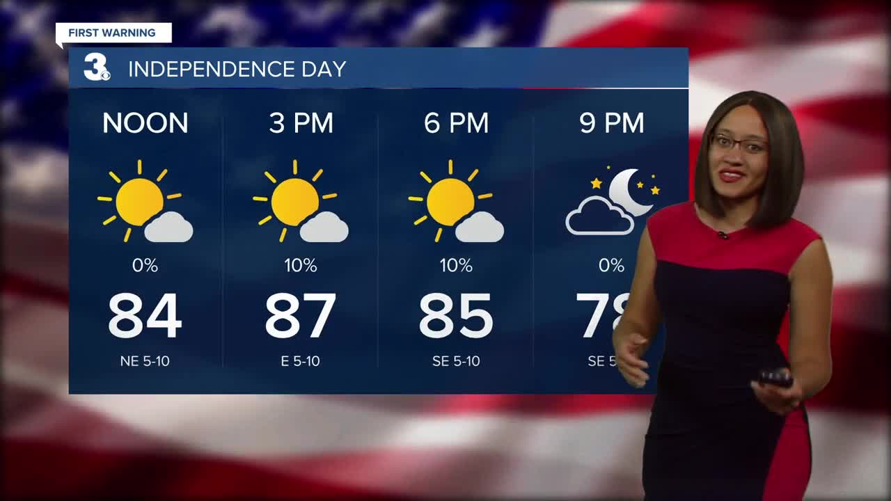
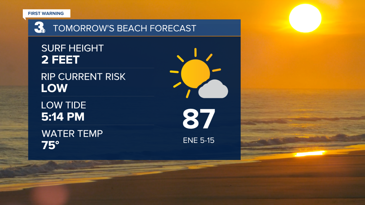
There will be lots of sunshine to enjoy for the 4th of July! A stray shower can’t be completely ruled out, but everyone looks to stay dry Monday. High temperatures will be in the mid to upper 80s with a slight breeze of 5-15 MPH.
If you’re going to the beach, conditions look great! Low rip current risk with 2 feet waves.
As we head into the workweek, rain chances and temperatures go up as we move into an unsettled pattern with a boundary hanging out to our north. High temperatures in the low 90s Tuesday with spotty PM showers. More scattered storm activity Wednesday and highs in the low 90s. Isolated storms for Thursday with slightly cooler temperatures. Highs both Thursday and Friday in the upper 80s. Back to scattered storms for Friday.

Since these storms largely depend on how the approaching front moves and where exactly it stalls out, expect some minor changes to the forecast. Either way, it’s likely we’ll have daily storms, but no washouts through the workweek.
Next weekend will be a little cooler. A cold front Saturday puts high temperatures to the mid 80s Saturday and low 80s Sunday. Isolated to scattered storms are still possible both days.
Connect with Meteorologist Kristy Steward:
