


Meteorologist Kristy Steward's First Warning Forecast
Good Friday night! What a wild Friday it’s been. We had record heat, then a line of severe storms. Now, the storms are over and we’re in for a treat this weekend.
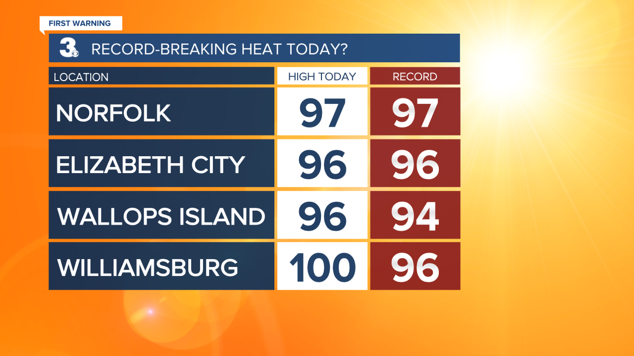
Many locations tied or broke their record high temperatures today. The record in Norfolk of 97° was tied, so was the 96° record in Elizabeth City. We set a new record high of 96° in Wallops Island, beating the 2014 record of 94°. We also set a new record in Williamsburg of 100°, beating the 1991 96° record.
A cold front tonight will usher in much cooler air.
Now that the storms have ended, clouds will clear overnight. Lows will still be warm around 70°.
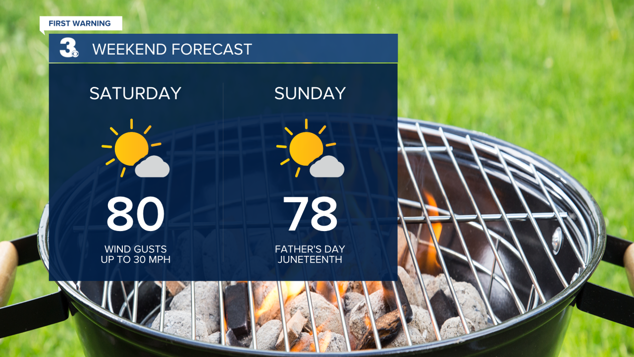
We notice the cool down this holiday weekend! High temperatures Saturday through Monday will be in the upper 70s to low 80s and there will be no humidity with mostly sunny skies. Breezy this weekend with 10-20 MPH winds and 30 MPH gusts.
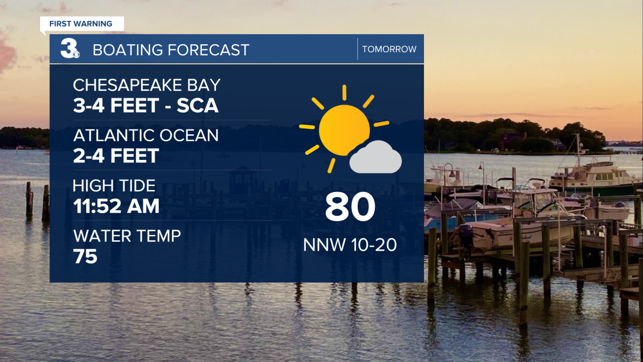
If you’re planning to get out on the water this weekend, it will be a little rougher. Moderate rip current risk in the Atlantic and Small Craft Advisory in the Chesapeake Bay with 2-4 feet waves.
Just in time for the official start to summer on Tuesday, the low 90s return. We’ll also have a bit more cloud cover in the sky, but remain dry. Late in the workweek, isolated storms will be possible as we move into an unsettled pattern.
Connect with Meteorologist Kristy Steward:
FACEBOOK
TWITTER
INSTAGRAM
