


Meteorologist Kristy Steward's First Warning Forecast
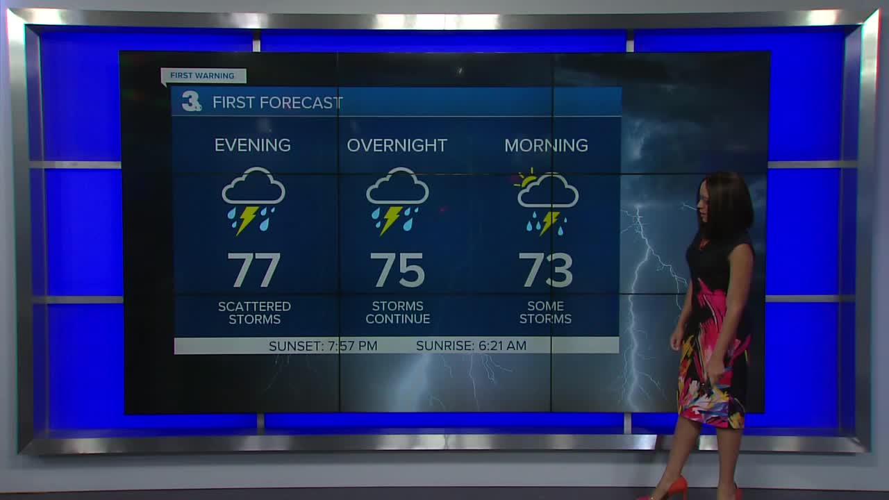
Good Sunday Evening! We have finally entered a cooler stretch and have relief from the extreme heat. High temperatures today hit the mid to upper 80s. We also had a healthy round of storms that started moving through this afternoon. Expect scattered rain to continue tonight. Areas that see continued rounds of heavy rain can expect to see localized flooding. Majority of the viewing area is under a Level 2 risk for flash flooding the rest of Sunday.
Isolated showers continue Monday morning with scattered rain and storms returning Monday afternoon/evening. That does bring up another flooding concern. Majority of us are under a Level 1 threat for flash flooding Monday. High temperatures tomorrow in the mid 80s.
High temperatures in the mid to upper 80s continues through the rest of the week along with daily isolated to widely scattered storm chances, primarily each afternoon and evening, as we stay in an unsettled pattern with many disturbances moving through Hampton Roads.
In the tropics, Tropical Storm Fred still looks to move through Alabama and Tennessee. Its track has shifted a bit more east, but is still far enough away from us we'll miss the greatest impacts. Mid-week, Fred's outer bands could bring us increased cloud cover and a few more rain showers. Tropical Storm Grace is heading to the central Gulf of Mexico, but once it's in the Gulf, its track is uncertain. So, it's still too early to tell if we'll see any impacts from Grace or not. Also in the Atlantic, near Bermuda, is a tropical wave that has a 40% chance of formation as it travels south-southwest. Right now, that wave will have no impacts on us in coastal VA/NC.
Meteorologist Kristy Steward
