


Meteorologist Kristy Steward's First Warning Forecast
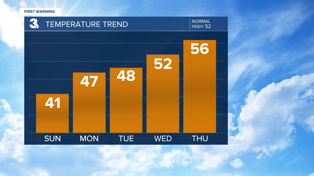
Happy Saturday evening! We have a frigid night ahead, then temperatures will begin on a warming trend Sunday throughout next week.
Under a mostly clear sky tonight, temperatures will drop down to the mid 20s. North-northeast winds of 10-15 MPH will put wind chill values in the mid to upper teens. Bundle up if you have any plans to be outdoors tonight/early tomorrow morning!
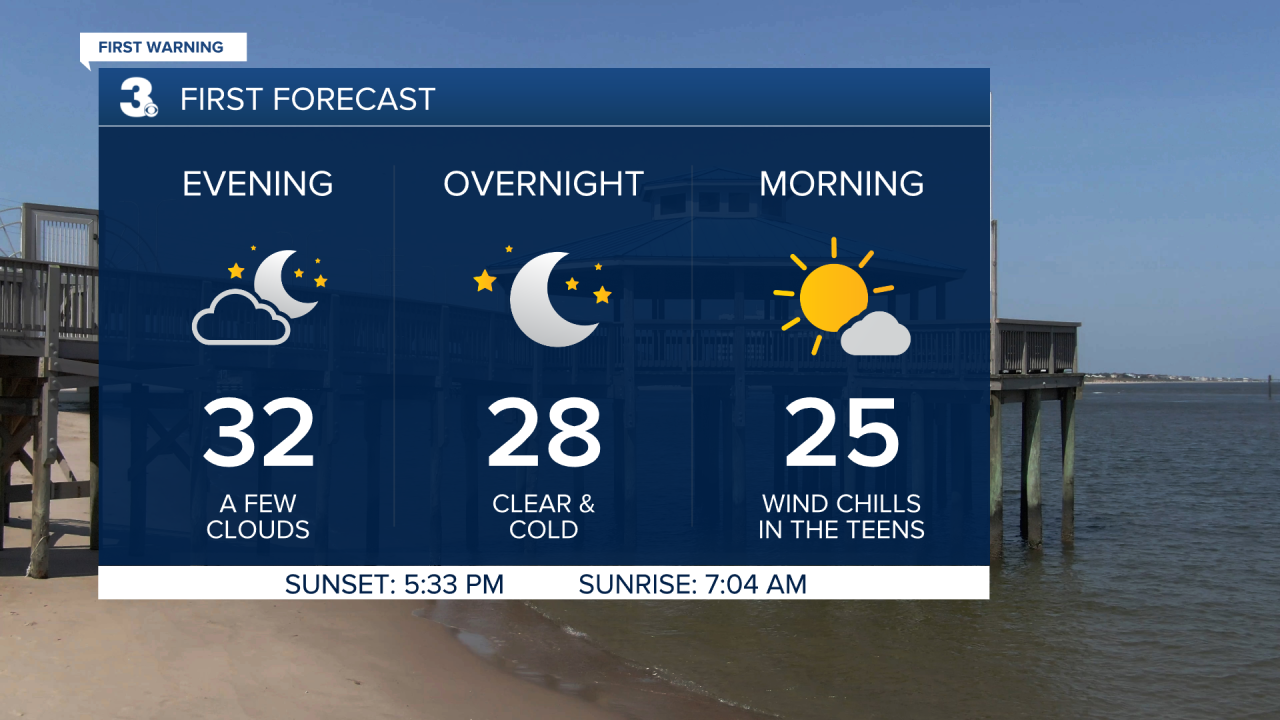
Sunday stays dry with a good amount of sunshine. Highs rise into the low 40s. Overnight lows Sunday night into Monday will be in the mid 30s.
A low pressure system rides offshore along the East Coast Monday. That will bring us scattered showers Monday into the early morning hours Tuesday. Clouds clear out Tuesday as high pressure starts to slide in. Lots of sunshine continues from Wednesday into the weekend.
High temperatures in the upper 40s Monday and Tuesday climb to the mid 50s by Thursday and remain there through next weekend.
Connect with Meteorologist Kristy Steward:
