


Meteorologist April Loveland's First Warning Forecast
Feeling like the triple digits… Temperatures will climb to the mid 90s today with an afternoon heat index between 100 and 105. We will see a mix of sun and clouds again today with another chance for a “pop-up” shower or storm.
Rain and storms will move in with a cold front to end the week. Expect scattered showers and storms Thursday afternoon to evening. Some storms could be strong to severe. Rain and storms will continue for Friday. Temperatures will drop behind the cold front, from the low to mid 90s on Thursday to the mid 80s on Friday.
This weekend will be cooler and less humid. Highs will drop to the low 80s on Saturday. Leftover showers/storms are possible as the cold front lingers along the coast. Expect lower rain chances on Sunday with highs in the mid 80s.
Weather & Health
Pollen: Low-Medium (Grasses)
UV Index: 10 (Very High)
Air Quality: Good (Code Green)
Mosquitoes: Very High
Tropical Update
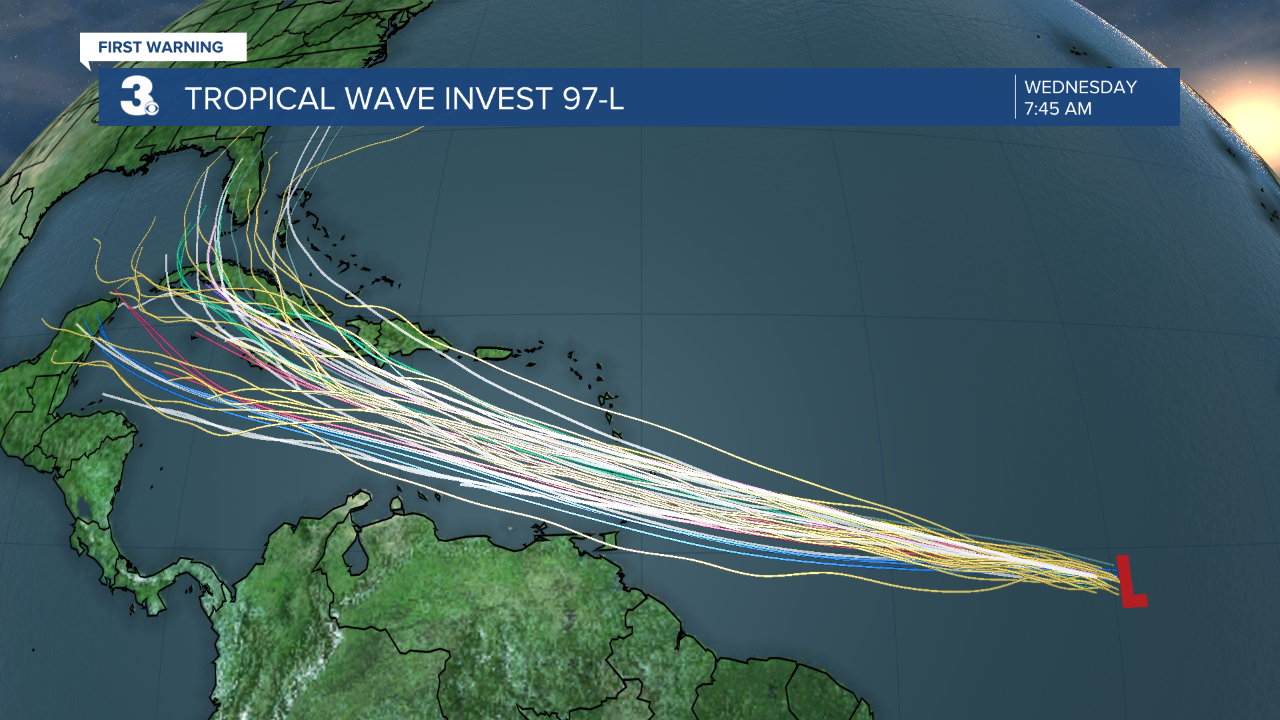
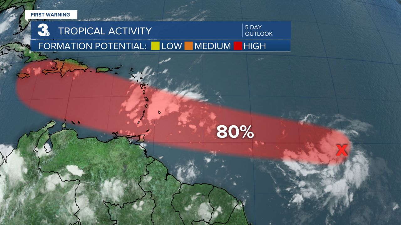
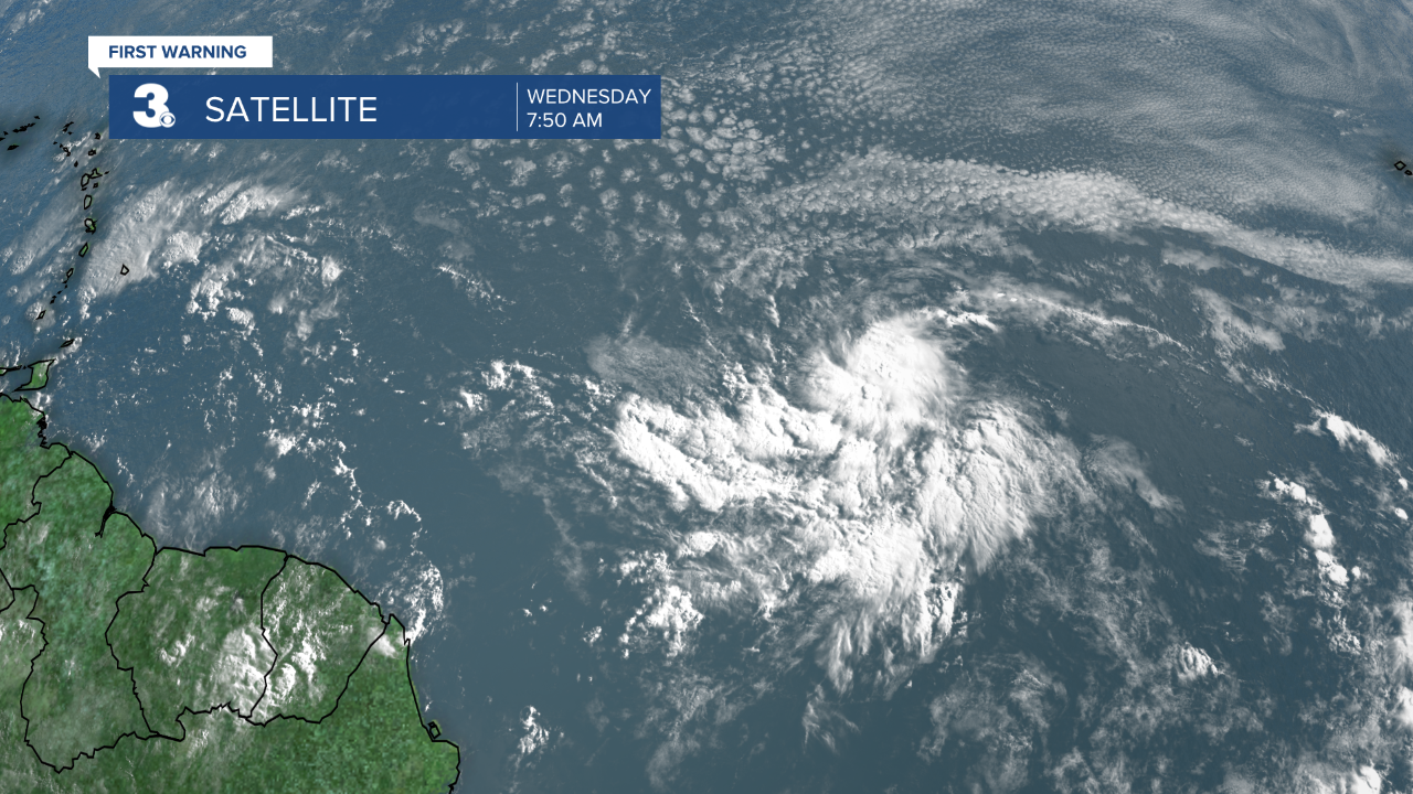
A broad low pressure area and tropical wave located about 1300 miles east-southeast of the Windward Islands have become better organized since yesterday. However, recent satellite wind data indicates that the disturbance does not have a well-defined circulation. Environmental conditions appear generally favorable for continued development, and a tropical depression or storm is likely to form during the next day or two while the system moves west-northwestward at 20 to 25 mph.
* Formation chance through 48 hours: HIGH (70%)
* Formation chance through 5 days: HIGH (90%)
A tropical wave located over the Lesser Antilles has become less organized since yesterday, and significant development is no longer expected while it moves quickly westward across the Caribbean Sea.
* Formation chance through 48 hours: LOW (10%)
* Formation chance through 5 days: LOW (10%)
Meteorologist April Loveland
For weather updates on Facebook: HERE
Follow me on Twitter: HERE
Follow me on Instagram HERE
Check out the Interactive Radar on WTKR.com: Interactive Radar
