


Meteorologist Kristy Steward's First Warning Forecast
*Freeze Watch Monday 3 AM - 9 AM for mainland Dare county. Temperatures are expected to drop as low as 30°. Prepare to protect any sensitive vegetation*

Good Saturday night! A cold front just passed through Hampton Roads. It brought us strong gusty winds today and squeezed out some light scattered rain showers. The rain has now ended and clouds have mostly cleared out, but the winds will stay as another front is heading our way Sunday.
Tonight, lows drop into the upper 30s, feeling like the mid 30s with 10-20 MPH west winds gusting to 30 MPH.
Sunday will be cooler. Highs in the mid 50s and still windy. Westerly winds of 15-25 MPH gust up to 35 MPH. Relative humidity values will still be low, below 30%, so we are all in an increased fire risk. Any fires that start could rapidly spread. Use extra caution when handling any potential ignition source. Sunday will be dry with some passing clouds.
The workweek will start off cold. Overnight lows Sunday night into Monday morning will be around freezing. Be prepared to protect any sensitive vegetation outside and bundle up with that winter jacket Monday morning. Monday stays breezy and highs only reach the low 50s. Freezing conditions again Monday night into Tuesday morning. Tuesday stays dry and cool in the low 50s.
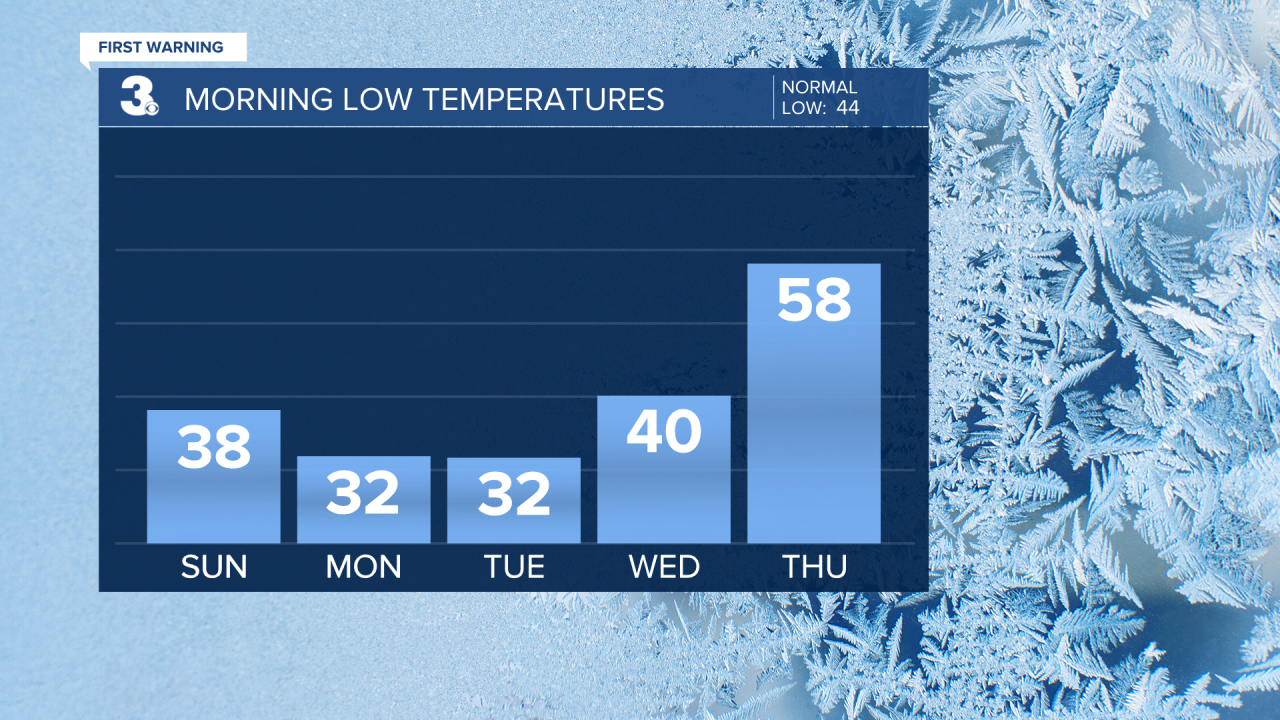
Temperatures soar into the mid to upper 60s Wednesday and near 80° Thursday. Scattered showers and possibly storms move through with a cold front Thursday afternoon into Thursday night. A few showers could linger into early Friday morning. Highs Friday in the low 70s drop to highs in the mid 60s Saturday. Lots of sunshine for at least the first half of next weekend.
Connect with Meteorologist Kristy Steward:
