


Meteorologist April Loveland's First Warning Forecast
Spring-like weather makes a quick return, and then back to below-normal temperatures. Unsettled weather will settle in for the rest of the week.
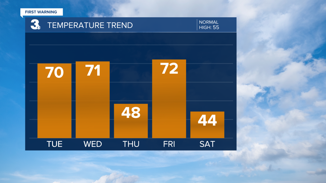
Clouds and spotty showers today, but it will be much warmer. Highs will warm to the low 70s. It will be on the windy side with winds out of the south at 10-20 mph. Expect a mild and cloudy night with lows in the upper 50s.
Several disturbances will move through the area through the end of the work week. Showers will develop Wednesday morning and move out by early afternoon. Temperatures will warm to the low 70s, but will fall into the 40s behind the cold front.

We will feel the result of the cold front on Thursday as highs will only warm to the upper 40s. You'll need the umbrellas once again.
If you're not a fan of the cold and wet weather, Friday will feature warm and wet weather. Expect highs in the low 70s with showers possible.
Temperatures will take another plunge on Saturday, but it will be dry with highs in the low and mid 40s.
Scattered showers will return on Sunday. There is a slight chance we could see a few flakes mix in, but right now, not looking like a big deal. Highs will be in the upper 40s.
Chilly again to kick off the work week. Skies will be partly cloudy with highs in the low 40s.
Meteorologist April Loveland
For weather updates on Facebook: HERE
Follow me on Twitter: HERE
Follow me on Instagram HERE
Check out the Interactive Radar on WTKR.com: Interactive Radar
