


Meteorologist April Loveland's First Warning Forecast
After two weekends with snow and frigid temperatures, many of you may be yearning for spring. And while the new season is still more than six weeks away, spring weather is right around the corner. A big pattern shift this week will send temperatures soaring, before an equally big plunge with send us back below normal for the weekend.

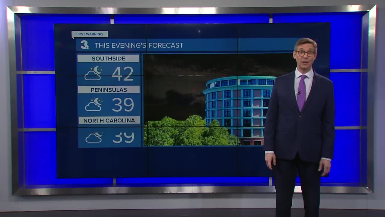
But it will still be chilly when you wake up on Tuesday morning, with temperatures in the low-to-mid 30s. Many areas should be right above the freezing mark. Some inland areas along with the Eastern Shore will fall into the 20s. Any area that still have snow, may have to deal with a little refreeze Tuesday morning.
This warming trend will continue as the week goes on. Partly cloudy on Tuesday with highs in the mid and upper 40s.
Even warmer heading into Wednesday with highs the mid and upper 50s. Patchy fog will be possible during the morning hours.
Thursday will be the warmest day of the week with highs in the low to mid 60s. Expect mostly cloudy skies with a few spotty showers. Can you believe we went from extreme cold and snow over the weekend to the 60s?
Rain and wind will be likely to end the work week. Temperatures will still be mild with highs in the low 60s.
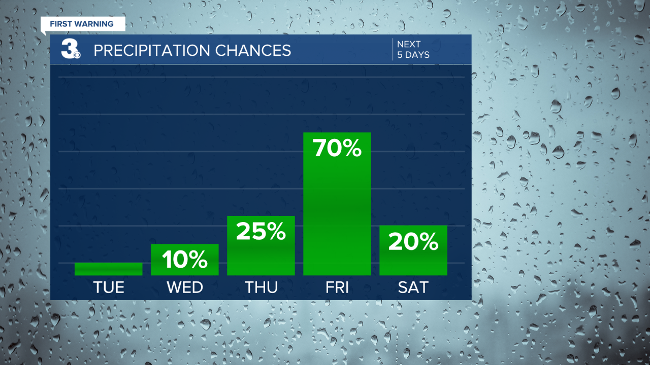
The Polar Plunge is Saturday and looks like our temperatures will be plunging as well. Highs will be in the upper 30s under partly cloudy skies. It will also be a bit breezy, making for wind chills in the 20s throughout the day.
Meteorologist April Loveland
For weather updates on Facebook: HERE
Follow me on Twitter: HERE
Follow me on Instagram HERE
Check out the Interactive Radar on WTKR.com: Interactive Radar
