


Meteorologist Kristy Steward's First Warning Forecast
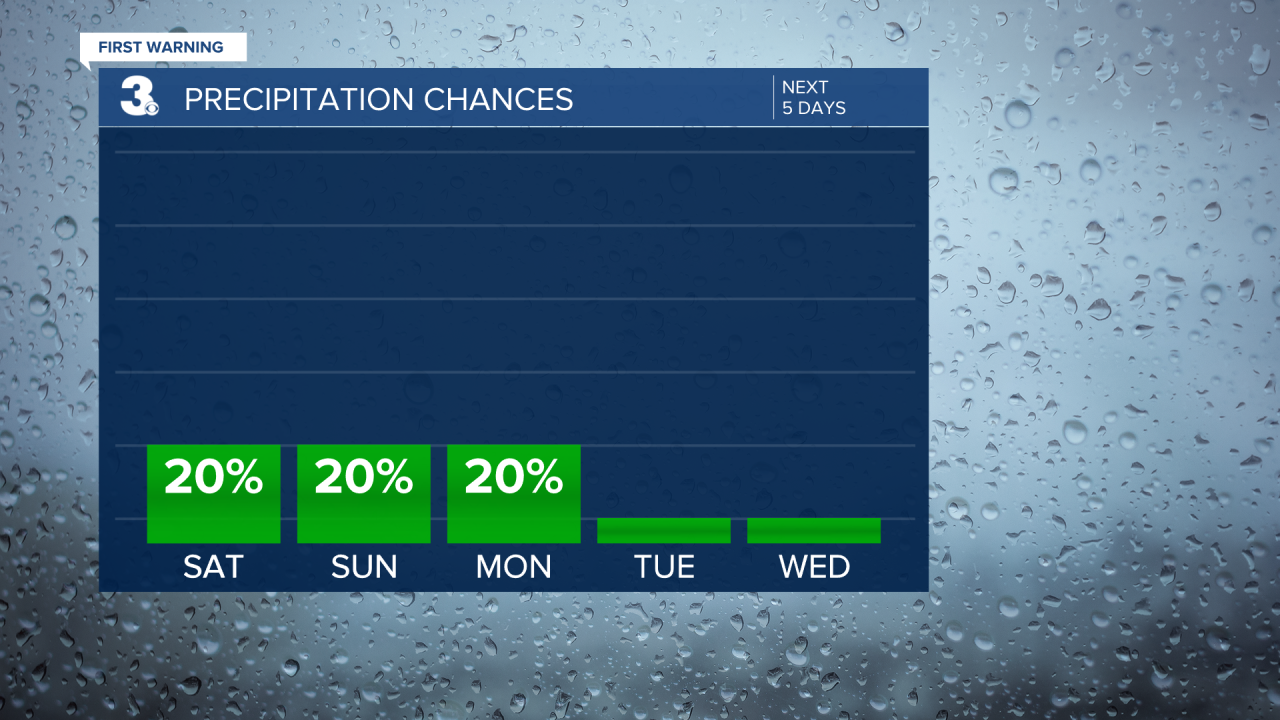
Happy Friday evening! Say goodbye to the 80s and hello to cooler air as we have two cold fronts impacting us this weekend. We’ll have some rain showers, but majority of this weekend is looking dry.
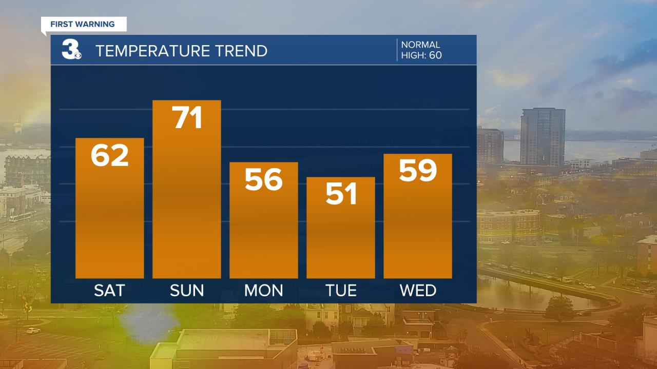
Scattered to isolated showers continue this evening into tonight. By sunrise Saturday, we’ll be nice and dry. Waking up to temperatures in the low to mid 50s. If you’re participating in the marathon or going to the parade, the weather will be nice. Dry, clearing clouds, and temps in the 50s. Later in the afternoon, high temperatures will rise into the lower 60s. Our far inland communities may be able to warm into the upper 60s.

St. Patrick’s Day, Sunday, will be mostly dry. Highs in the low 70s. Possibly a stray shower around sunrise, but the better chance for rain will be in the middle of the night late Sunday night/early Monday morning. That’s when another cold front will pass through.
Next week is going to be much cooler. Highs in the mid 50s Monday and almost 10° below-average on our first day of Spring, Tuesday, with highs in the low 50s. The second half of the week warms up to the more seasonable upper 50s and low 60s.
Much of the workweek is looking dry with plenty of sunshine. Scattered rain showers return next Friday.
Connect with Meteorologist Kristy Steward:
FACEBOOK
TWITTER
INSTAGRAM
