


Meteorologist Kristy Steward's First Warning Forecast
Happy Mother’s Day! Unfortunately it was a gross day with windy light rain showers and mist most of the day. Rain showers will become more isolated over the next few days, but we stay windy and that will continue to bring us more tidal flooding and ocean overwash.
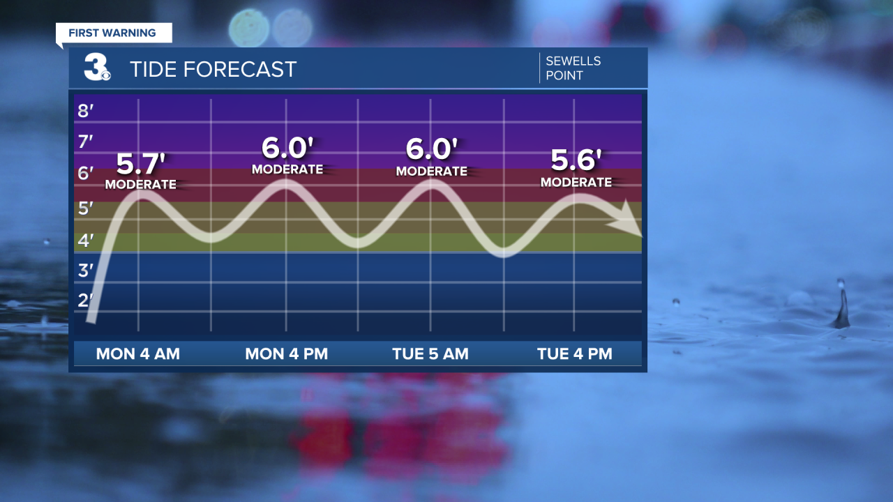
Coastal Flood Warning remains in effect until 12 PM Tuesday for our coastal VA communities. Up to 3’ inundation expected with moderate tidal flooding during the next several high tide cycles.
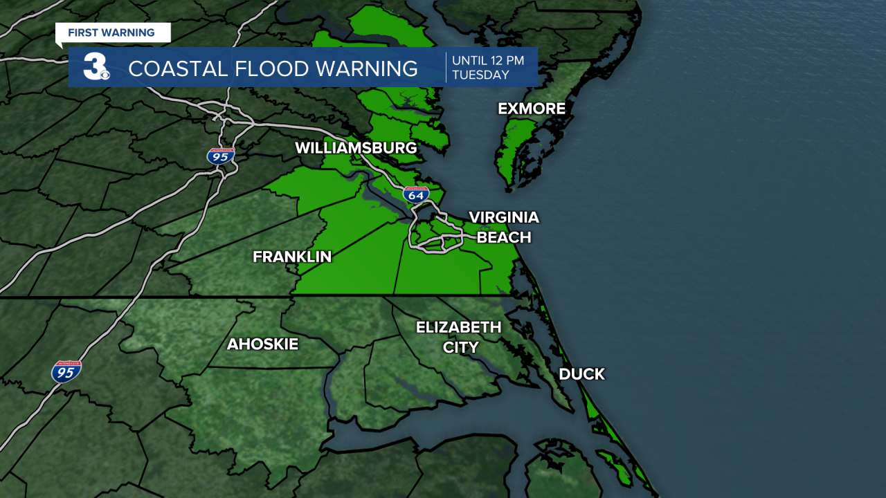
Strong 15-25 MPH north-northeasterly winds with gusts up to 40 MPH persist through Thursday. That means coastal flooding could continue to be a concern through then.
Another big concern is ocean overwash, especially along HWY 12 in the Outer Banks. 10-14’ waves Monday and Tuesday. Waves begin to subside late Wednesday to 7-9’.
Waves in the Chesapeake Bay will be 4-7’ Monday - Wednesday.
Eventually, the second half of the week, this low pressure system parked just offshore will move a bit more south and a warm front will head our way from the east. That helps warm temperatures up, but also brings the return of more rain showers and storms.
Monday through Wednesday we’ll be drier with just isolated shower activity and we’ll stay with cool temperatures. Highs in the upper 50s Monday to mid 60s Wednesday. Temperatures continue to gradually climb all week, reaching near 80° by the end of next weekend. However, rain showers become scattered again Friday and Saturday with the possibility of some storms.
Connect with Meteorologist Kristy Steward:
