


Meteorologist Kristy Steward's First Warning Forecast
Happy Saturday night! It was a beautiful day today and tomorrow is going to be just as nice, just a little warmer.
We stay dry and mostly clear tonight into Sunday. Lows in the low 60s warm to highs in the mid to upper 80s Sunday afternoon. We stay with high temperatures in the low to mid 80s the first couple days of next week.
A strong cold front heads our way Tuesday. This front will bring us breezy conditions, scattered showers and storms, and a big cool down.
Expect scattered storms Tuesday afternoon and evening around the front with lingering scattered lighter rain Tuesday night into Wednesday morning.
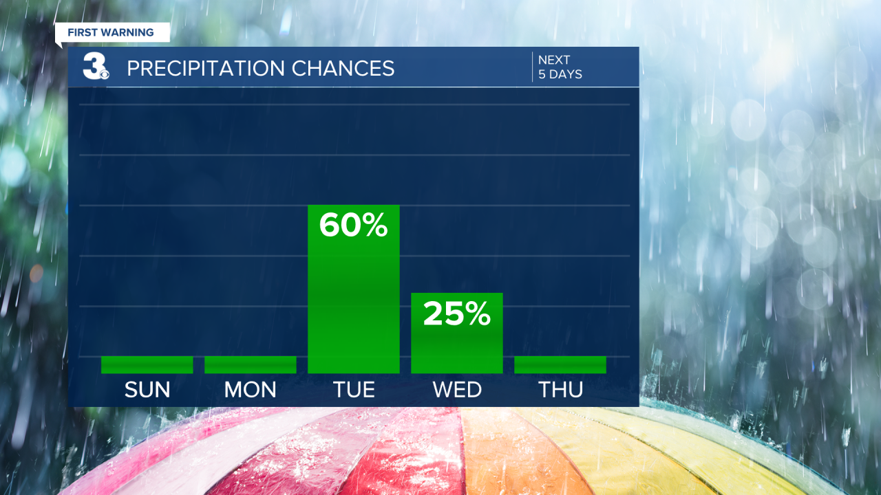
This front will drop high temperatures from the 80s down into the mid 60s Wednesday. Temperatures rebound a bit into the more seasonable low 70s Friday, staying there next weekend. Lots of sunshine and mostly dry conditions also return.

Connect with Meteorologist Kristy Steward:
