


Meteorologist Kristy Steward's First Warning Forecast
Happy Tuesday night! It was a steamy day with many locations feeling like the low 100s and upper 90s. We have one more day of high heat before a cold front comes to our rescue. Then, we’ll be in for a stormy stretch.
Tonight, a disturbance to our north could bring the Peninsulas a few showers, but most of the rain will dissipate before it reaches our northern communities. We stay warm, a bit breezy, and partly cloudy overnight. Lows in the mid 70s.
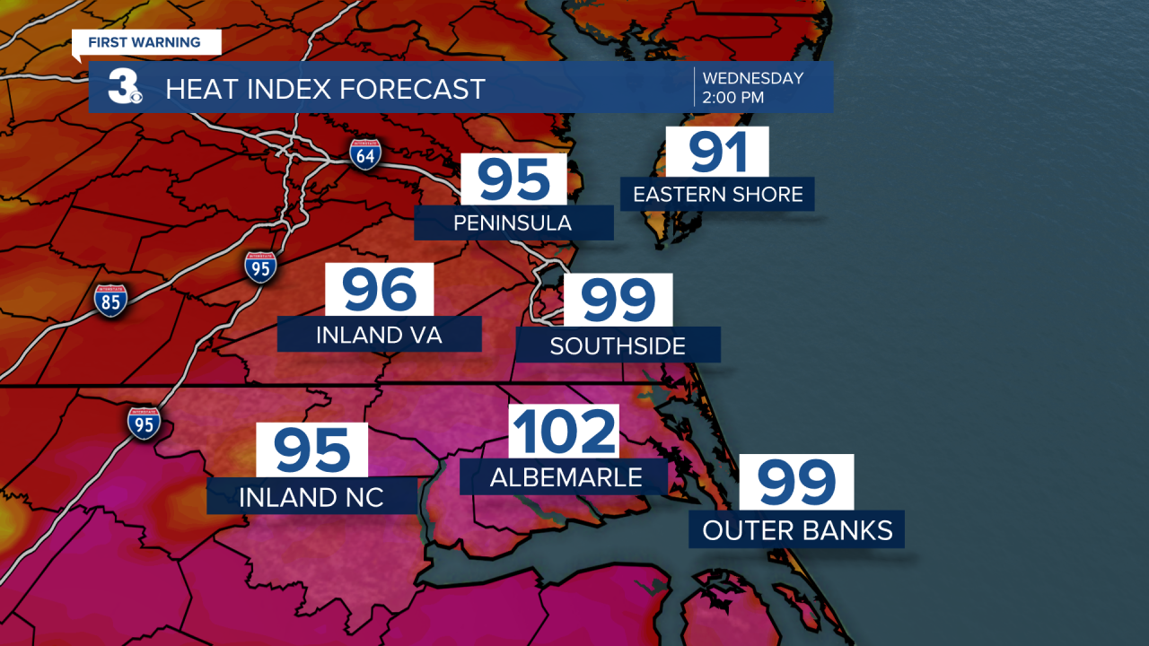
Wednesday will still be toasty with highs in the low 90s and heat indices in the mid to upper 90s.
An approaching cold front will bring us scattered storms starting around 2-3 PM. Some of these storms Wednesday afternoon and evening could become strong to severe. Majority of the area is under a level 1 of 5 risk for severe storms. The main threats are damaging wind gusts. Heavy downpours will also be around.

This cold front will stall over us through the weekend, then we’ll have another disturbance over us for the start of the workweek. This will keep us in a stormy pattern. Each day there will be isolated to scattered storm chances. Not a washout any day, but a good idea to keep the umbrella or rain jacket close by.
With this stormy pattern, temperatures will be cooling down. Highs in the upper 80s Thursday and mid 80s for the start of the weekend. Of course, being in mid-July, this cool down will be short-lived. Temperatures gradually climb back to near 90° for the start of the workweek.
Connect with Meteorologist Kristy Steward:
FACEBOOK
TWITTER
INSTAGRAM
