


Meteorologist Kristy Steward's First Warning Forecast
Good Sunday night! Highs today were in the upper 80s to low 90s with a pleasant breeze. Temperatures will climb the first half of the week, then a cold front comes to our rescue!
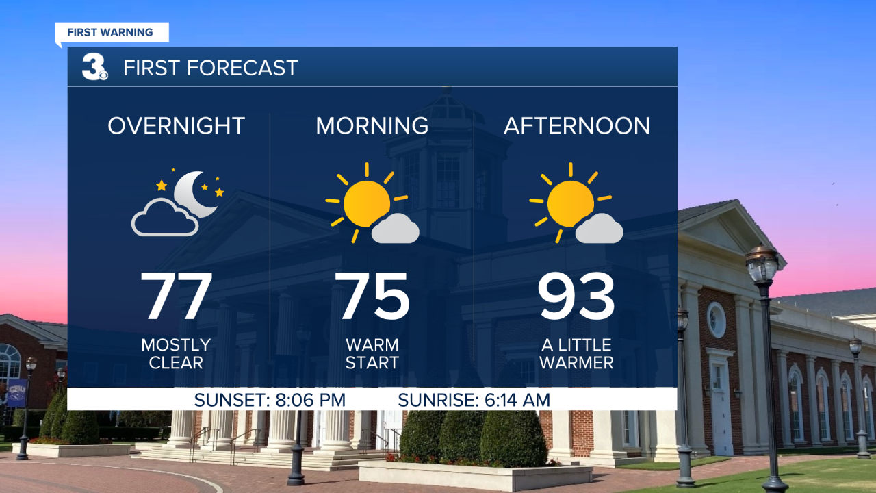
Mostly clear and dry tonight with lows in the mid 70s. Highs Monday in the low to mid 90s, feeling like the low 100s. Mostly dry and mostly sunny to start the workweek.
Tuesday will be the hottest day this week. Highs in the mid 90s with heat index values of 105-110°. A few PM storms look to pop-up Tuesday. More scattered storms arrive later Wednesday ahead of an approaching cold front.
Still hot Wednesday in the mid 90s, but temperatures drop into the mid 80s behind the front Thursday. Scattered storms remain Thursday, especially in the afternoon and evening hours.

Behind the cold front will be a second reinforcing cold front that's followed by a Canadian high pressure system. This means we’ll stay with highs in the mid 80s through the weekend and we’ll get to enjoy low humidity. Mostly dry with tons of sunshine this weekend.
Connect with Meteorologist Kristy Steward:
FACEBOOK
TWITTER
INSTAGRAM
