


Meteorologist Kristy Steward's First Warning Forecast
Happy Thursday evening! We were a little warmer today in the mid 80s. While temperatures won’t continue to climb, our humidity will be along with our storm chances.
A front with a couple areas of low pressure riding along it will start to head our way tonight from down south. That will increase our cloud cover overnight, but we will stay dry tonight. A little warmer with lows in the upper 60s.
Friday will be a gloomier day with lots of cloud cover, but much of the day should remain dry. Spotty showers could start to move in Friday afternoon and evening, however, the bulk of the rain looks to hold off until after Midnight. Highs still in the mid 80s Friday.
Saturday starts off soggy. Widespread rain and storms throughout Saturday morning. We dry out Saturday afternoon and should be able to see some sunshine later in the day too.
Sunday will be the drier of the two days, but still some afternoon and evening storm chances. Sunday will be a few degrees warmer than Saturday, in the mid 80s, and there will be higher humidity.
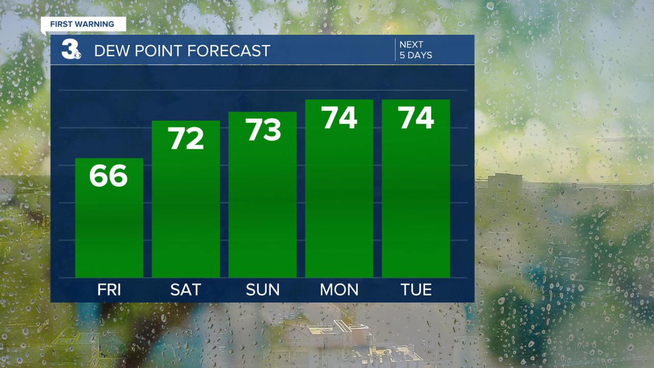
Dew points climb to the mid 70s starting Sunday and they stay there through the workweek. That’s at the oppressive level where it feels like you’re wearing the air as soon as you step outside.
While humidity will be high, temperatures will stay below-average in the low to mid 80s through the workweek. There will also be daily storm chances. Scattered activity Monday becomes isolated the rest of the week.
Connect with Meteorologist Kristy Steward:
FACEBOOK
TWITTER
INSTAGRAM
