


Meteorologist April Loveland's First Warning Forecast
Summer-like feel today through the rest of the week. Temperatures will trend in the upper 80s to near 90, with humid conditions.
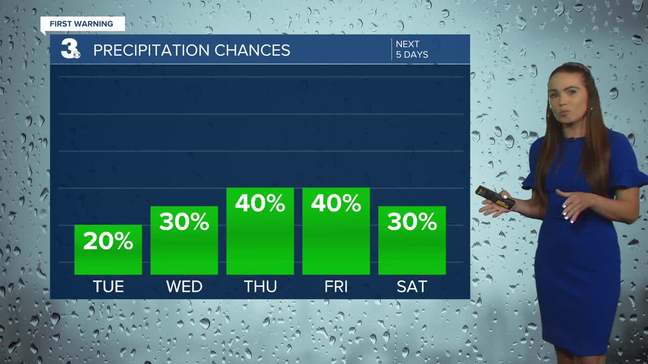
We'll continue with the chance for a few isolated showers today as a warm front lifts north of the area. We also have tropical depression Fred to the west, which will mainly be affecting the mountains, but a little moisture could sneak into the area. Highs will warm to the mid 80s, but it will feel hotter due to the humidity.
A few afternoon storms will be possible on Wednesday. It will be warmer with highs in the upper 80s.
Scattered storms on Thursday. It will be the hottest day of the week with highs near the 90 degree mark, but will feel closer to the triple digits.
The unsettled weather pattern will carry into the end of the week and into the weekend. Highs will be in the upper 80s with afternoon storms possible everyday. Not expecting a washout.
Mostly dry and warm heading into the start of the work week with highs in the upper 80s.
Tropical Update
Meteorologist April Loveland
For weather updates on Facebook: HERE
Follow me on Twitter: HERE
Follow me on Instagram HERE
Check out the Interactive Radar on WTKR.com: Interactive Radar
