


Meteorologist April Loveland's First Warning Forecast
A gloomy start to 2021. Showers will be possible this morning, especially across the peninsulas and Eastern Shore as a warm front lifts over the area. Otherwise, expect fog and mist. Some areas are seeing dense fog, so exercise caution if you're out and about. It will be mild with highs in the upper 60s and low 70s. The record high is 75 degrees. It will turn windy with winds out of the southwest at 10-20 mph, with gusts up to 25 possible.
Mild overnight with lows in the 60s. The warmest record low is 55, so we could definitely break it. Showers will move in late as a strong cold front approaches.
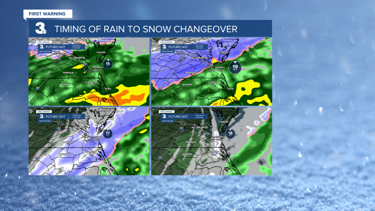
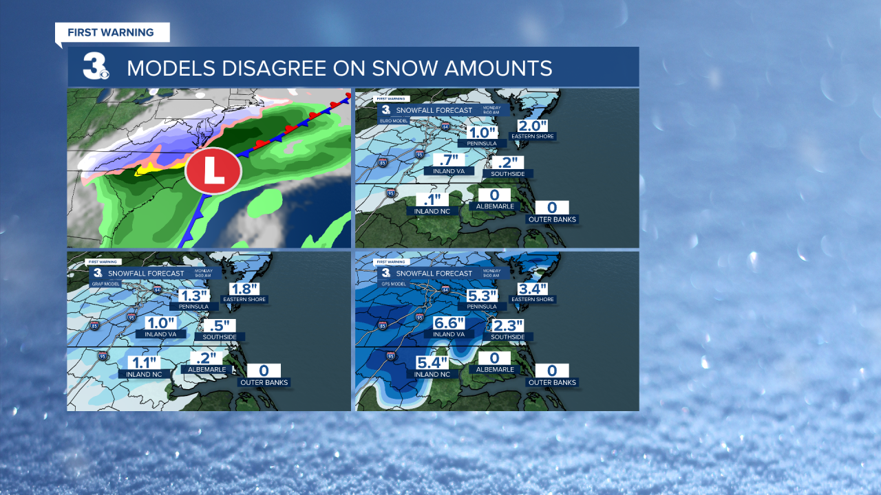
Showers will continue to move in early Sunday and continue through the day. It will be another mild day with highs in the mid 60s to near 70. Much colder air will arrive from the northwest Sunday night as the cold front moves offshore. An area of low pressure will form along the cold front bringing a rain/snow mix to the area. Rain will transition to a very wet snow or a wintry mix early Monday. This will unfortunately continue through the morning commute. Accumulations will be less than 1 inch due to the warm ground. Expect any accumulation to happen on grassy and elevated surfaces. Drier air will move in by early afternoon as high pressure moves in. It will be much colder with highs only reaching the upper 30s and low 40s. It will be windy once again with winds out of the northwest at 15-25 mph, with gusts up to 30 mph.

Mostly clear and frigid overnight. We haven't felt temperatures like this in awhile. Expect lows in the upper 20s and low 30s.
Finally! Sunshine will break out on Tuesday. It will be deceiving though! Highs will only warm to the mid and upper 40s.
The dry weather will continue on Wednesday with highs in the mid 50s.
More clouds will build in on Thursday. Highs will warm to the mid and upper 50s once again. Showers will be possible late.
We'll continue with a slight chance for showers on Friday. Highs will cool to the upper 40s.
Meteorologist April Loveland
For weather updates on Facebook: HERE
Follow me on Twitter: HERE
Follow me on Instagram HERE
Check out the Interactive Radar on WTKR.com: Interactive Radar
