

Meteorologist Kristy Steward's First Warning Forecast
Good Saturday evening! Today was another fantastic Fall-like day! Many of us started the day in the 50s and only warmed up to around 80°. Unfortunately, our nice little taste of Fall is coming to an end tomorrow.
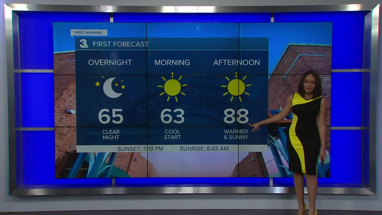
Tonight, lows will still get pretty cool. Inland communities can expect to wake up to temperatures in the mid to upper 50s while our coastal communities will have temperatures in the mid 60s.
Sunday temperatures will return to above-normal in the upper 80s. However, our low humidity gets to stick around a little longer as does the plentiful sunshine.
Monday and Tuesday look to be the hottest days this week. Highs in the low 90s. The workweek starts off dry with lots of sunshine continuing as a high pressure system remains over us. The second half of next week, an area of low pressure is set to move up the east coast. That will drop our temperatures and increase our rain chances. Highs in the upper 80s Wednesday to mid 80s Thursday to more seasonable low 80s Friday into next weekend. A few showers are possible Thursday, mainly for our NC counties, but everyone will have a better chance for scattered showers and storms Friday and Saturday.
Meteorologist Kristy Steward
