


Meteorologist April Loveland's First Warning Forecast
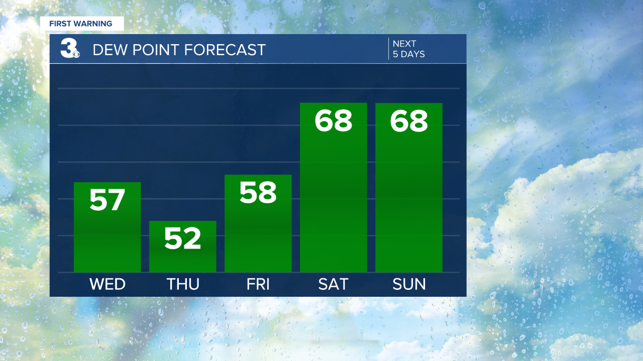
A cooler and less humid end to the work week… Highs will reach the low 80s today, about 5 degrees below normal for this time of year. Expect a nice mix of sun and clouds today. A scattered shower or storm is possible this afternoon, but rain will not be widespread.
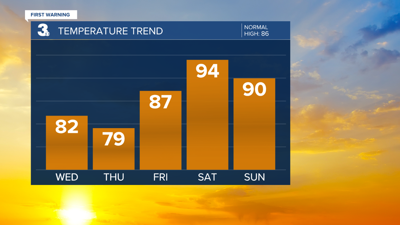
Highs will struggle to reach the 80s tomorrow with even lower humidity. We will see a mix of sun and clouds tomorrow with a spotty shower possible. Expect more sunshine on Friday with highs warming to the mid and upper 80s.
We will be back to a summer-like pattern this weekend. Highs will warm to the low and mid 90s with more humidity. Scattered showers and storms could pop up each afternoon/evening.
Tropical Update:
Bill becomes extratropical 300+ miles east of Halifax, Nova Scotia. The post-tropical low is expected to dissipate on Wednesday.
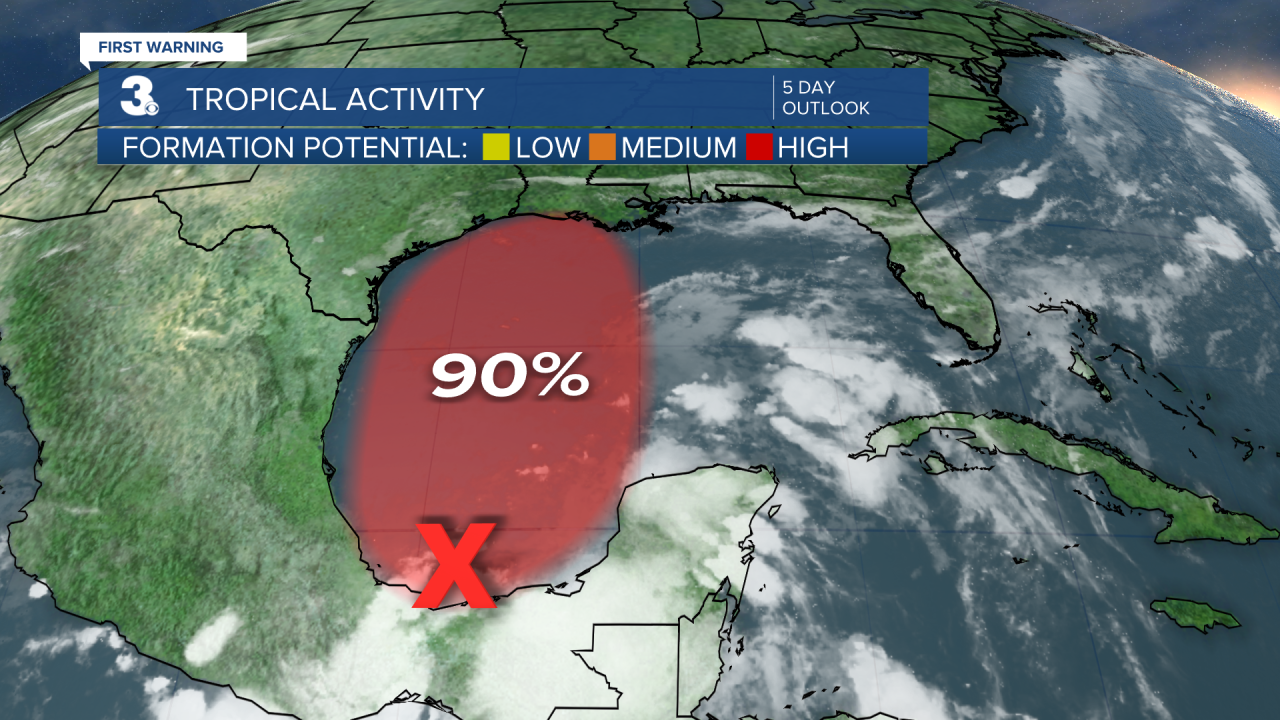
Disorganized showers and thunderstorms continue over the Bay of Campeche and southern Mexico in association with a broad low pressure area. This system will move little during the next day or so, and little if any development is expected during that time due to interaction with land. However, the broad disturbance should begin to move northward on Thursday, and a tropical depression is likely to form by late Thursday or on Friday when the low moves across the western Gulf of Mexico.
* Formation chance through 48 hours: High (70%)
* Formation chance through 5 days: High (90%)
Meteorologist April Loveland
For weather updates on Facebook: HERE
Follow me on Twitter: HERE
Follow me on Instagram HERE
Check out the Interactive Radar on WTKR.com: Interactive Radar
