


Meteorologist Kristy Steward's First Warning Forecast
Good Sunday night! Today was beautiful with dry conditions, a mix of sun and clouds, and highs in the 80s. Tomorrow won’t be quite as nice. Severe storms will roll through Monday afternoon and evening.
Ahead of that storm threat, we stay mostly quiet tonight. A few isolated to widely scattered showers and possibly a rumble of thunder could pass through overnight. If you’re in one of the few areas that sees a little rain tonight, expect a bit of patchy fog Monday morning. Otherwise, tonight will be partly cloudy and warm. Lows in the mid 60s.
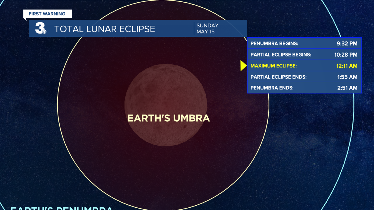
Don’t forget to look up tonight and peer between the clouds or you’ll miss the total lunar eclipse! It’s actually dubbed the Super Flower Blood Moon Lunar Eclipse because it will be a full moon and supermoon (when the moon is closest to the Earth, appearing bigger and brighter in the night sky). The Flower part comes from this being the time of year when many flowers are in bloom. It will also turn reddish in color because of the eclipse, hence Blood Moon. The partial eclipse begins at 10:28 PM Sunday, peaks at 12:11 AM Monday, and ends at 1:55 AM Monday. Our next total lunar eclipse won’t be until November 5, 2022.
Monday starts off pleasant, dry with a mix of sun and clouds. As the day goes on and the cold front gets closer, southwest winds get breezier. 10 - 20 MPH with gusts up to 30 MPH. Temperatures will get a little warmer in the mid 80s.
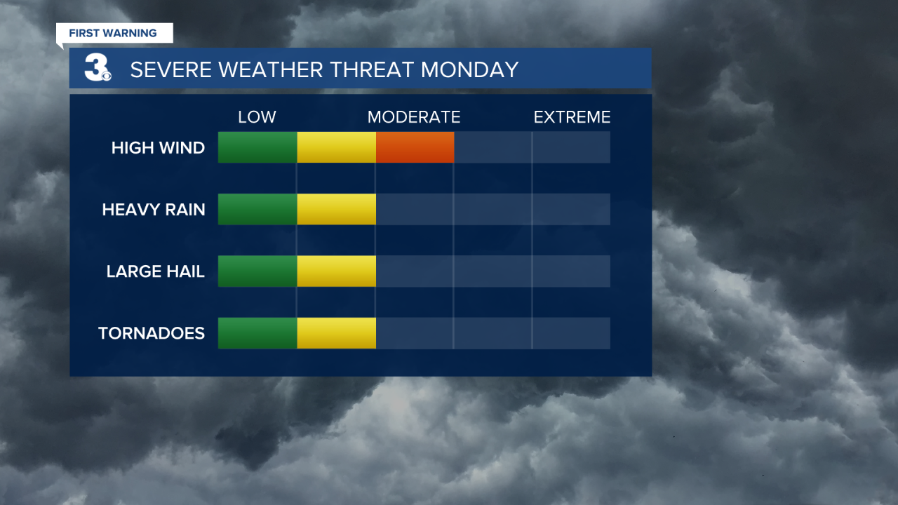
Monday afternoon is when things take a turn. A line of strong to severe storms starts to move in from the west around 2 PM, reaching southside around 4-5 PM, and clearing out of the Outer Banks by 10 PM. We are all under a Level 2 out of 5 risk for severe weather.

The main threat is damaging winds. However, larger hail and a few isolated tornadoes can’t be ruled out.
As soon as this front passes, we dry out and clouds quickly clear out. We’ll have tons of sunshine Tuesday and slightly cooler temperatures with highs around 80°.
Our coolest day next week will be Wednesday with highs in the mid 70s. Still plenty of sunshine and mostly dry.
A warm front Thursday morning is set to bring us isolated to widely scattered storms throughout the entire day. It will also really send our temperatures soaring. Highs in the low to mid 80s Thursday climb to around 90° Friday and Saturday. Both of those hot days will be mostly dry.
A cold front Sunday cools us back down into the low 80s, brings us windy conditions, and possibly isolated to widely scattered storms.
Connect with Meteorologist Kristy Steward:
