


Meteorologist April Loveland's First Warning Forecast
A few showers this weekend, warmer with increasing rain chances next week.
Wall-to-wall sunshine today with a range of high temperatures. Areas closer to the coast will be in the 50s, while locations inland should break into the low 60s. Clouds will build in this evening ahead of an area of low pressure.
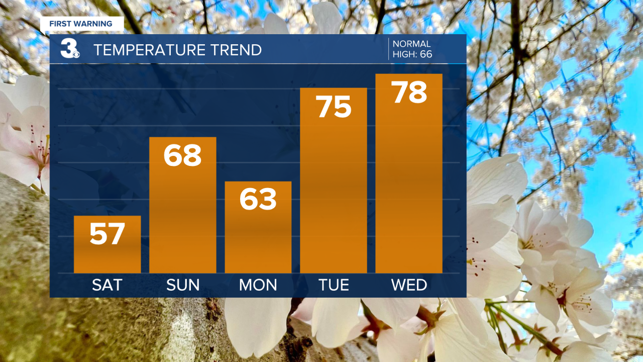
Showers will move in overnight and early Sunday. Mainly in North Carolina and along the Virginia coast. Looking like everything should move out by 8 AM. Skies will clear for the rest of the day and temperatures will warm to the upper 60s.
Sunshine to kick off the work week with highs in the low 60s.
Unsettled weather will be the story for Tuesday, Wednesday and Thursday. Tuesday we'll warm to the mid 70s with rain moving in late. Rain will continue overnight and into the day Wednesday. Wednesday will be the warmest day with highs in the upper 70s. Scattered storms will be possible on Thursday with highs in the mid 70s.

Drier and cooler to end the work week. Highs will be in the mid and upper 60s, which is seasonable for this time of year.
Check out your Pollen Forecast:

Meteorologist April Loveland
For weather updates on Facebook: HERE
Follow me on Twitter: HERE
Follow me on Instagram HERE
Check out the Interactive Radar on WTKR.com: Interactive Radar
