

Meteorologist Kristy Steward's First Warning Forecast
Good Sunday night! This afternoon turned out to be quite an active one. An area of low pressure over Hampton Roads pulled in some moisture from Henri and caused the slow-moving heavy downpours over us. While we've dried out now, continue to watch for ponding on roadways tonight.
Lingering sprinkles are possible into the earlier part of tonight. Clouds linger tonight, keeping lows in the low 70s. If you see some breaks in the clouds tonight, patchy fog could form in that area. Otherwise, clouds will gradually clear out Monday.
Monday afternoon and evening a line of storms will likely move across our North Carolina counties. After that, we all dry out the rest of the week. A few stray quick PM pop-up showers are possible, but most of us will remain dry.
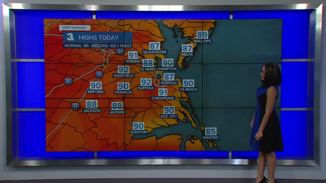
The trade-off for the drier weather will be higher heat and humidity. Highs climb into the low 90s, feeling like the low 100s each day. Overnight lows drop to the mid 70s.
Meteorologist Kristy Steward
