


Meteorologist April Loveland's First Warning Forecast
Much colder air is moving in. A few rain and snow showers possible this afternoon and evening. Another warm up headed our way by midweek.

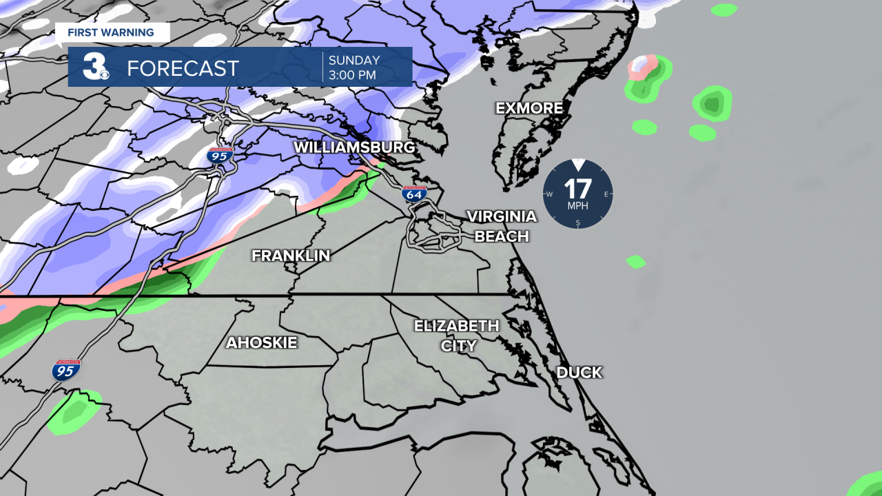
An area of low pressure will move along the stalled front that brought us much colder air. This will bring the chance for showers after 2 PM. As temperatures drop, we will see a transition to snow. Temperatures will hover just above the freezing mark as most of the precipitation falls, so any snow that falls will be very wet. This, on top of the warmer ground temperatures will limit accumulations. We could see a dusting up to a 0.5 inch through early Monday. This will not be a big rain or snow maker.

Valentine's Day and the workweek starts off mostly dry and cold. A few lingering flurries are possible Monday morning, but they won't amount to anything. Highs Monday in the upper 30s with clearing clouds. It will be breezy, which will make temperatures feel closer to the teens during the morning hours and the 20s during the day.

High pressure brings us lots of sunshine Tuesday and Wednesday as well as warmer temperatures. Highs in the upper 40s Tuesday. Even warmer on Wednesday as highs soar to the low 60s. We could even hit 70° Thursday!
A slowly approaching cold front late-week brings scattered showers late Thursday into Friday. Showers will be possible during the afternoon on Thursday and will become likely on Friday. Friday will be a bit cooler, but still above normal with highs in the upper 50s.
Meteorologist April Loveland
For weather updates on Facebook: HERE
Follow me on Twitter: HERE
Follow me on Instagram HERE
Check out the Interactive Radar on WTKR.com: Interactive Radar
