


Meteorologist Kristy Steward's First Warning Forecast
Good Sunday night! If you didn't get to enjoy the warmth today, you have one more chance tomorrow before temperatures take a tumble.
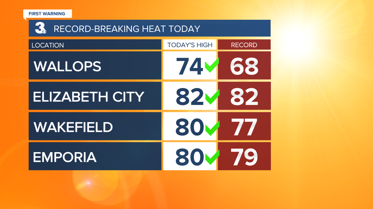
Today we skipped ahead to the end of Spring. Highs soared into the upper 70s and low 80s courtesy of a strong southwesterly wind flow. Wallops set a new record high today of 74°, beating its 68° record. Wakefield also set a new record at 80°, beating out its record of 77°. Emporia beat its 79° record by touching 80° today. Elizabeth City tied its record high at 82°. Expect more potentially record-breaking warmth Monday!
As we stay under the warm sector of this system tonight, temperatures will only drop into the low to mid 60s. We stay windy tonight with south-southwest winds of 10-20 MPH. Clouds clear out in the overnight hours and return throughout periods of the day Monday.
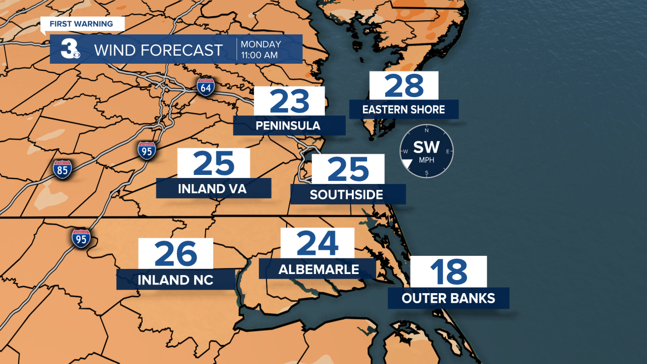
Monday will be similar to today. Near-record warmth, windy, and mostly dry. With south-southwest winds of 15-25 MPH gusting to 35 MPH and a partly cloudy sky, temperatures climb a couple more degrees into the low maybe even mid 80s. We could potentially tie or set a couple more records.
Ahead of a strong cold front, scattered rain showers start to move in from the northwest between 7-10 PM Monday. Scattered rain showers continue along the front until sunrise Tuesday. This cold front will knock high temperatures down to the mid 50s Tuesday. After the front passes through, it will stall to our south later Tuesday and an area of low pressure will form along it. This boundary sticks around through Friday until it eventually gets pushed out by a cold front Saturday. All of this means we will move into a cooler, wetter pattern for much of the week.
Expect highs in the low 50s Wednesday and Thursday with widespread to scattered rain showers both days. We should catch a break in the rain Friday and temperatures bump up to the low 60s. Around the cold front, we could see scattered thunderstorms Friday night into Saturday afternoon. With rapidly dropping temperatures, the Peninsulas and Eastern Shore may see a couple snow flakes mixed in at the tail end of the precipitation. If you do, they won't amount to anything. That cold front is set to drop our temperatures down into the low 30s Saturday night and highs in the upper 40s next Sunday. High pressure Sunday will help clear out the rain and clouds.

Connect with Meteorologist Kristy Steward:
