


Meteorologist Kristy Steward's First Warning Forecast
Good Sunday night! Today was chilly, but we'll soon get to trade in our winter jackets for t-shirts and umbrellas. A warmer, wetter weather pattern is on the way.
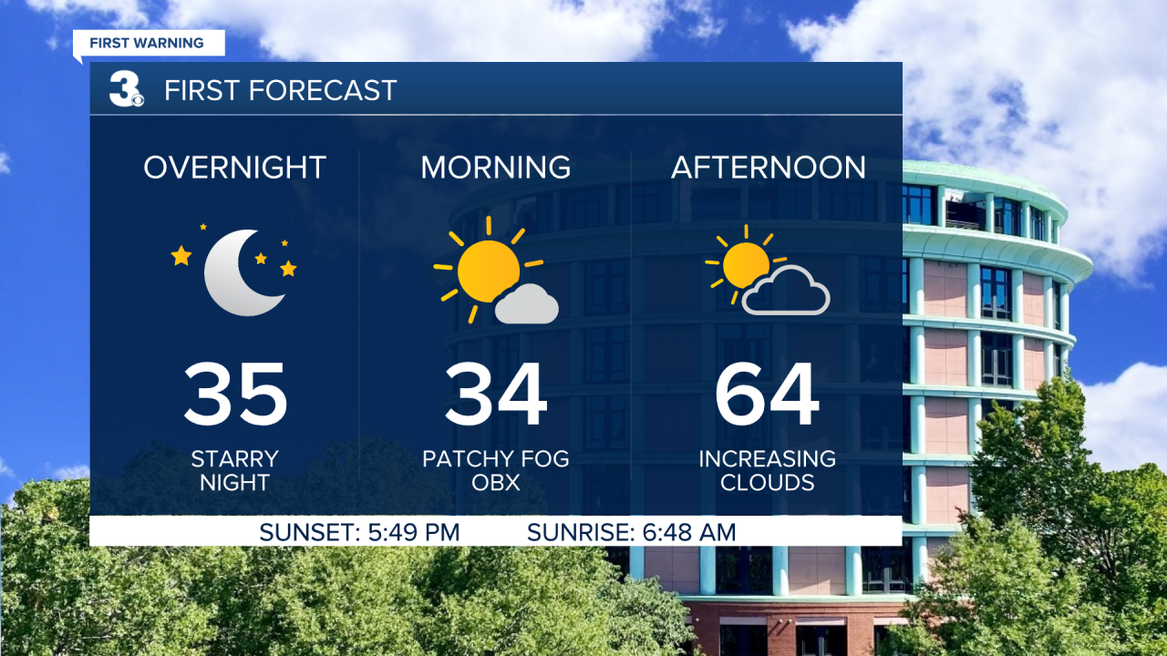
Tonight stays dry and clear. Lows drop to the mid 30s. With 5-10 MPH southerly winds, warmth and moisture will continue to work its way up from down south. With light winds, increasing moisture and a clear night sky, there's the possibility for fog to form Monday morning, especially along the Outer Banks.
Clouds gradually increase throughout Presidents Day, but we remain dry. Overall, it's going to be a great holiday! High temperatures in the mid 60s. The workweek won't be quite as nice.
Mostly cloudy, breezy and wetter weather settles in for the workweek. On Tuesday, a few showers will be possible, mainly across inland VA, the Peninsulas, and Eastern Shore. A lot of us will be able to stay mostly dry throughout the day though. Off and on scattered showers will mainly impact us Wednesday-Friday. Ahead of a cold front, temperatures return to near 70° Tuesday and Wednesday. The cold front makes its way through Wednesday evening and drops high temperatures to around 50° Thursday.
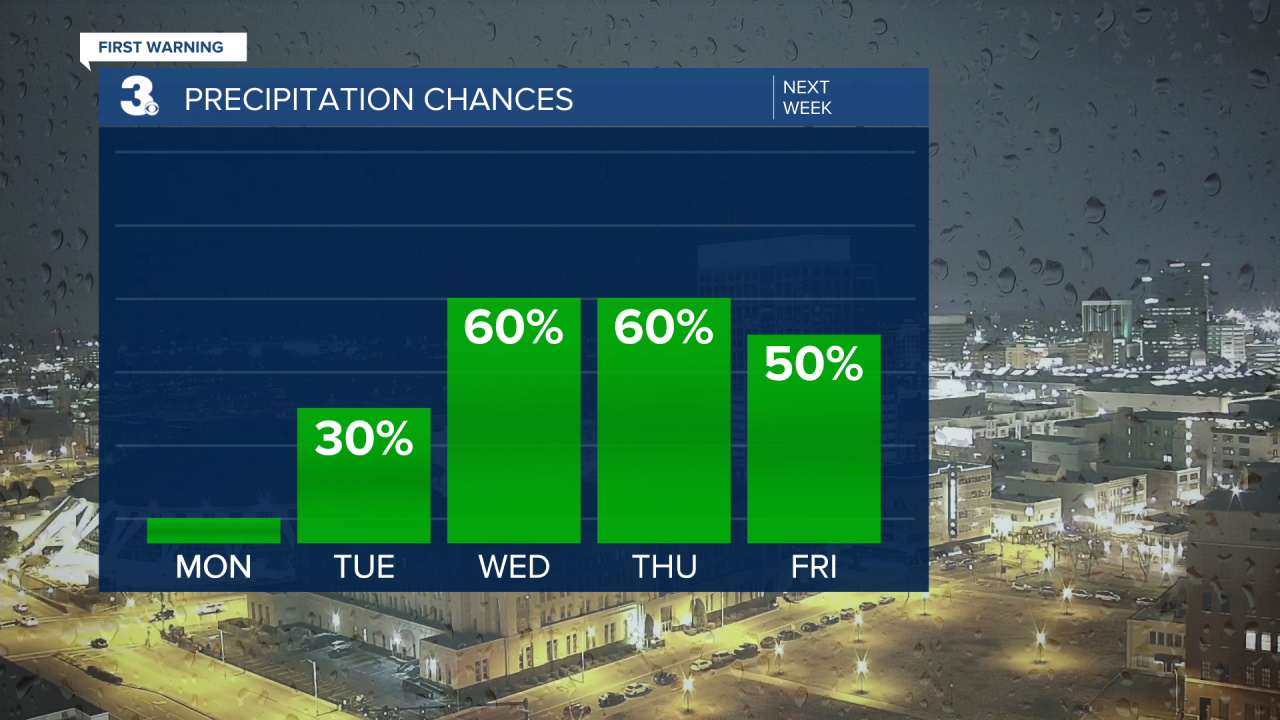
That front will develop an area of low pressure along it Thursday and begin to travel north again, bumping our temperatures up to the mid 60s Friday. Then, that system pushes east and another cold front moves through Hampton Roads. That one will cool us down to the mid 40s Saturday and around 50° next Sunday.
Next Sunday, there's also the chance for us to see more snow flurries. There's still a lot of uncertainty with that setup though. One of our long range models has us getting just a few rain showers. The other one has us getting widespread rain that turns to snow near the end of the event. Of course, as the week goes on, we'll get a clearer picture of what to expect and we'll keep you updated. Stay tuned and keep your fingers crossed for your preferred scenario!
Connect with Meteorologist Kristy Steward:
