


Meteorologist April Loveland's First Warning Forecast
A nice mix of sun and clouds on tap today. Temperatures will be mild with highs in the mid 60s. Enjoy today! We are about to enter a very unsettled stretch of weather.
Even though we will be dealing with several days of wet weather, the temperatures will be very spring-like. Expect highs in the 60s through midweek.

An area of low pressure will impact the area on Monday. This will bring some showers, mainly along the coast. Temperatures will warm to near 60.
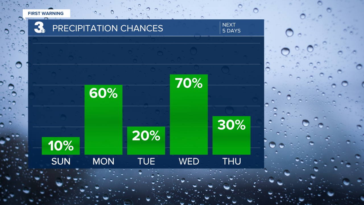
We could see a few lingering showers on Tuesday, with more clouds than sunshine for the rest of the day. Highs will warm to the low 60s.
The wettest day will be on Wednesday. Expect clouds and rain during the day with highs in the low 60s.
Scattered showers will be possible on both Thursday and Friday. Thursday will be milder with highs near 60. It will be a few degrees cooler on Friday with highs in the mid and upper 50s.
As of now, Saturday is looking a little on the wet side. Temperatures will rebound to the low 60s.

Meteorologist April Loveland
For weather updates on Facebook: HERE
Follow me on Twitter: HERE
Follow me on Instagram HERE
Check out the Interactive Radar on WTKR.com: Interactive Radar
