


Meteorologist Kristy Steward's First Warning Forecast
Happy Thursday evening! It was nice seeing the sun return this afternoon. We’ve got one more dry day before rain moves in the first half of the weekend. Then, we’ll actually be able to dry out.
Friday will be a slightly cooler day with high temperatures in the mid 50s, but it will be dry. There will be a mix of sun and clouds, likely more clouds than sun in the sky throughout the day.
A system impacts us Saturday. An area of low pressure will bring us scattered rain showers, gusty winds, and tidal flooding throughout the daytime hours. A few rumbles of thunder are also possible.
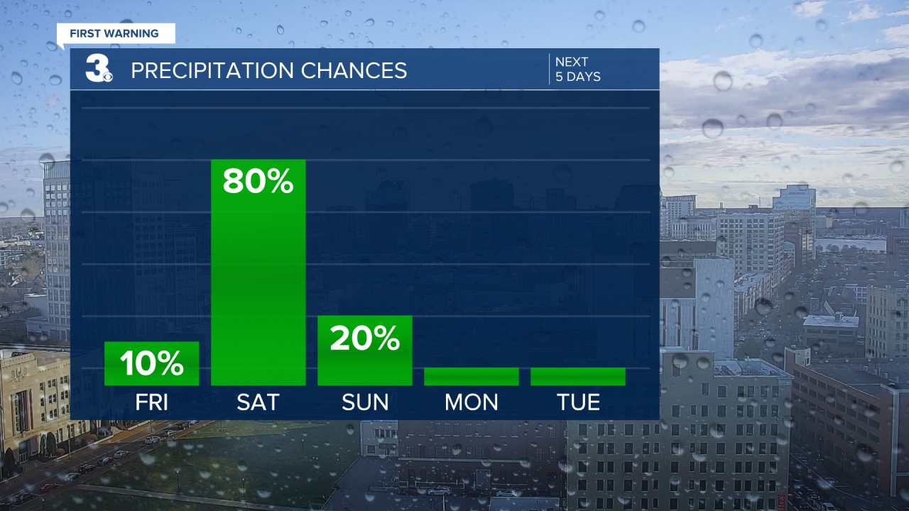
Clouds clear out Sunday morning, leaving us with a mostly sunny and dry day. Breezy winds stick around. High temperatures will be near 60° both days this weekend.
Don’t forget about Daylight Saving Time beginning Sunday at 2 AM! We spring forward an hour.

The workweek is looking nice! We’ll get the dry break we need with tons of sunshine all week long thanks to high pressure settling in. High temperatures start in the upper 50s Monday and gradually warm to 70° by Thursday. A nice early arrival of Spring!
Connect with Meteorologist Kristy Steward:
FACEBOOK
TWITTER
INSTAGRAM
