


Meteorologist Kristy Steward's First Warning Forecast
Happy Saturday night! Hopefully you got outside to enjoy the gorgeous weather we had today! If not, you’ll have another chance Sunday. Enjoy these cooler temps and lower humidity while you can because soon the heat, humidity, and storms will be back.
Tonight, we’ll have a few passing clouds, but able to stay dry and mostly clear. Expect temperatures a little cooler in the low 60s.
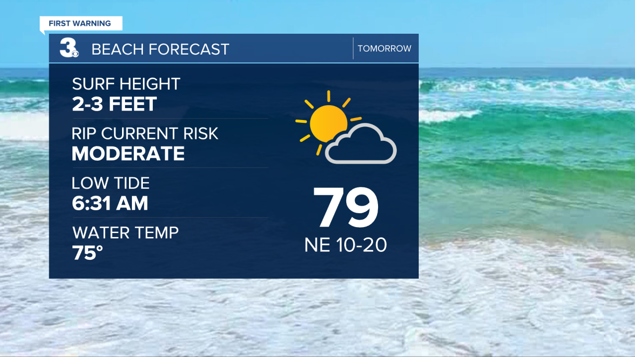
Sunday, we’ll have some passing clouds at times and we will become breezy. 10-20 MPH northwest winds as a weakening cold front passes through. We will still stay dry and have high temperatures in the upper 70s. If you’re going to the beach, watch for rip currents. As what should soon become tropical storm Alex heads into the Atlantic offshore, it will bring us a rougher surf. Moderate rip current risk Sunday with 2-3’ waves and high rip current risk Monday with 4-5’ waves.
Monday will be a nice day. Lots of sunshine and dry as high pressure briefly nudges in from the north. Highs around 80°.
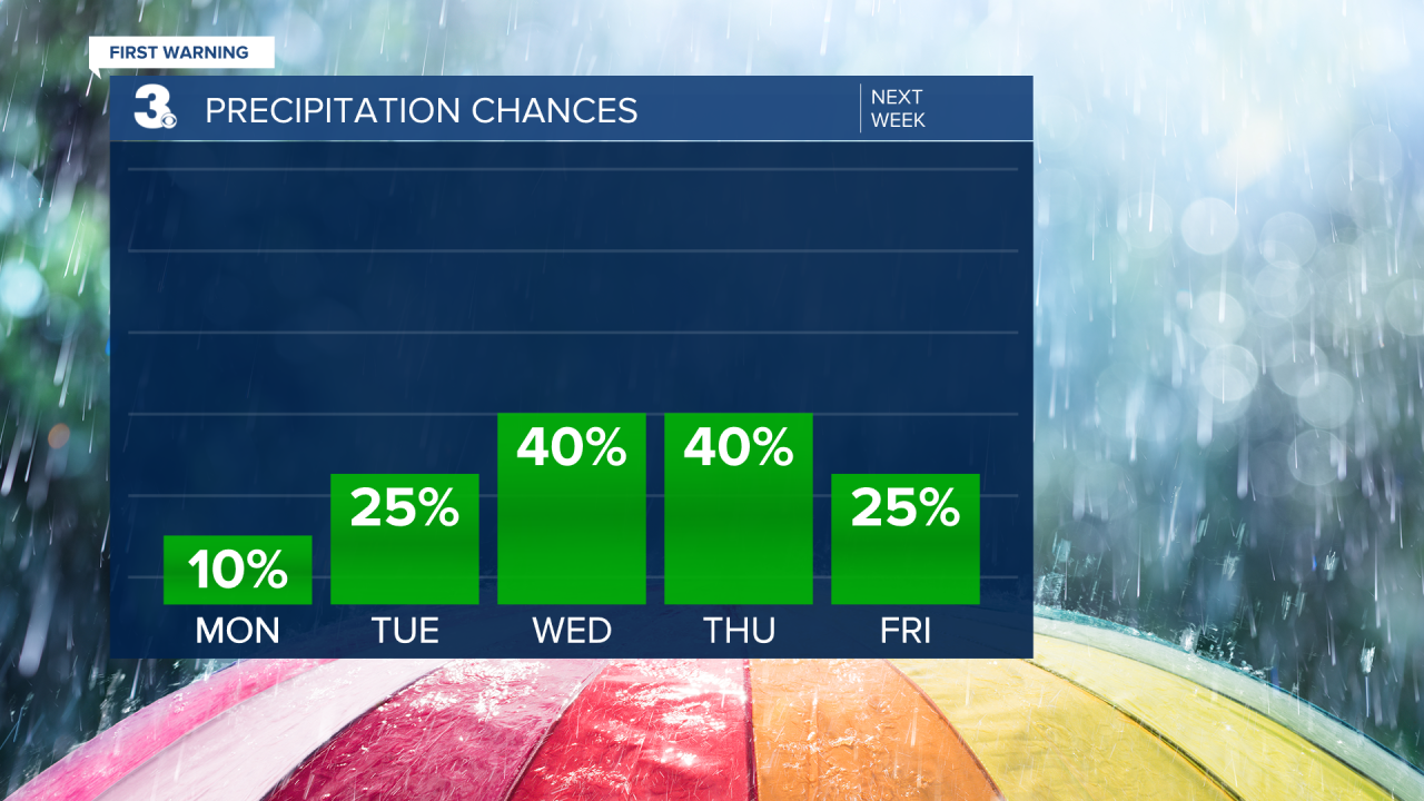
The heat and humidity returns for most of the workweek, starting Tuesday. Highs in the mid 80s rise into the upper 80s midweek. Isolated storms Tuesday become more scattered for Wednesday and Thursday. Then, a few spotty storms Friday before scattered storms again Saturday around a low pressure system heading our direction. Temperatures heading into next weekend will be a little cooler in the mid 80s. It will also become breezier.
Tropical Update:
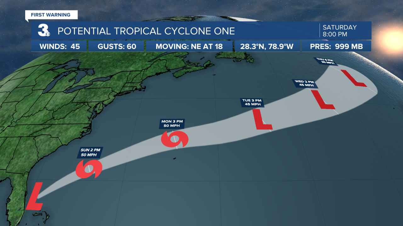
Potential Tropical Cyclone One is now to the east of Florida and moving out of the Bahamas. It’s moving northeast at 20 MPH with 45 MPH sustained winds and is forecast to stay in the Atlantic. It is continuing to strengthen and is expected to soon become Tropical Storm Alex. Still a 90% chance of formation in the next 48 hours. Locally, we will see a rougher surf Sunday and Monday.
Connect with Meteorologist Kristy Steward:
