


Meteorologist April Loveland's First Warning Forecast
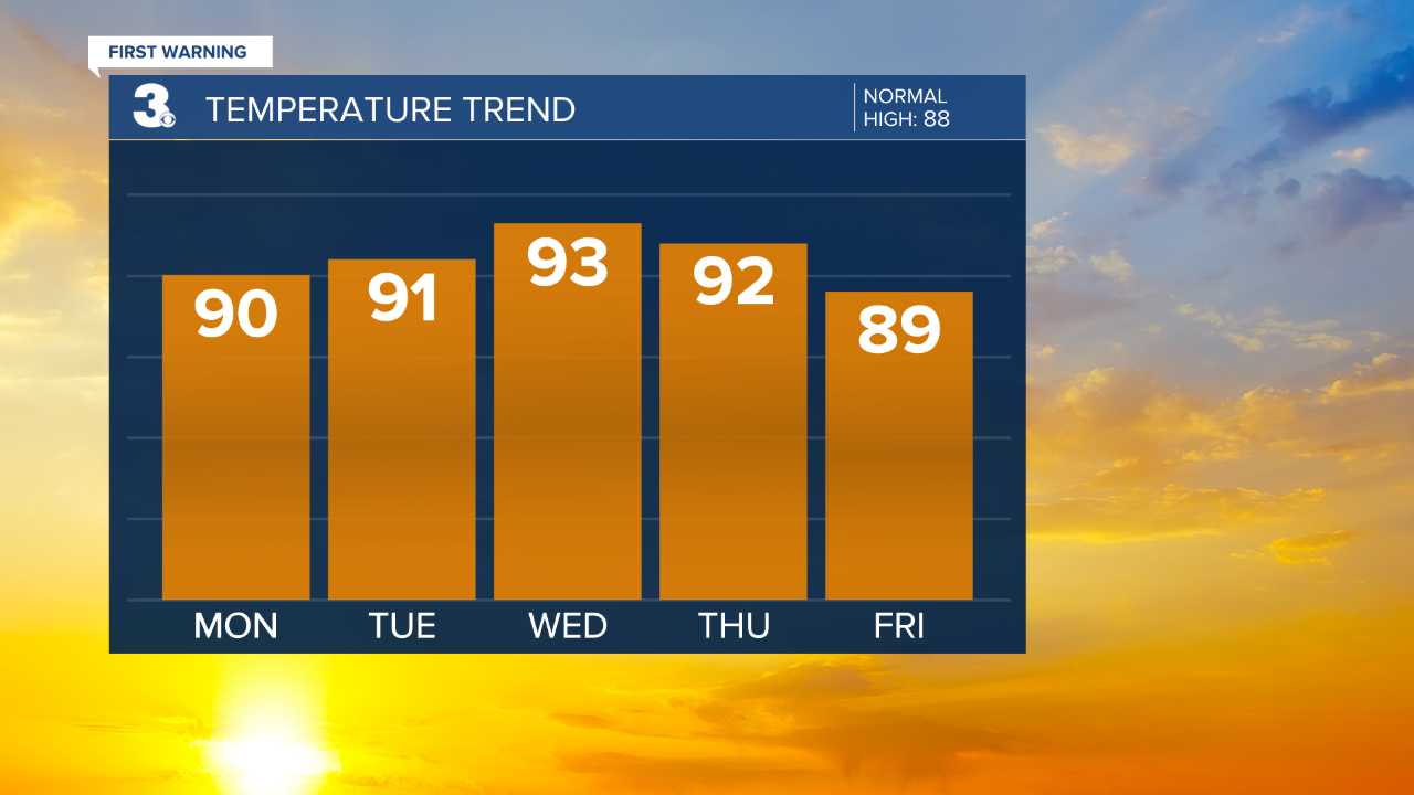
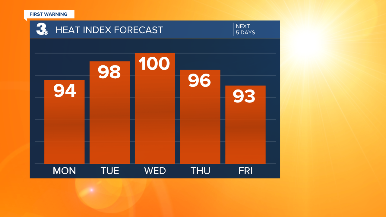
Plenty of sunshine to start the work week as high pressure continues to build over the area. It will be hot and humid with highs in the upper 80s to near 90 under sunny skies. Keeping a slight 10 percent chance for a pop-up shower due to all the heat and humidity. Mild and humid overnight with lows in the low 70s.
The heat and humidity will continue to build on Tuesday with highs in the low 90s. It will feel closer to the upper 90s. Sunshine and low rain chances will be the story.
Shower and storm chances will go up a bit my midweek as a disturbance moves in. Keeping chances for a stray shower or storm Wednesday with highs in the low 90s. It will be hot and humid with highs in the low 90s. It will feel closer to the triple digits. We'll enter an unsettled stretch of weather Thursday through Saturday as a disturbance moves in. Afternoon storms will be possible on Thursday with Scattered showers and storms Friday and Saturday. Highs will warm to 90 on Thursday and Friday and the upper 80s on Saturday. Dewpoints will be in the low 70s all week, making for humid conditions.
Weather & Health
Pollen: Low-Medium (Grasses)
UV Index: 10 (Very High)
Air Quality: Good (Code Green)
Mosquitoes: Very High
Tropical Update
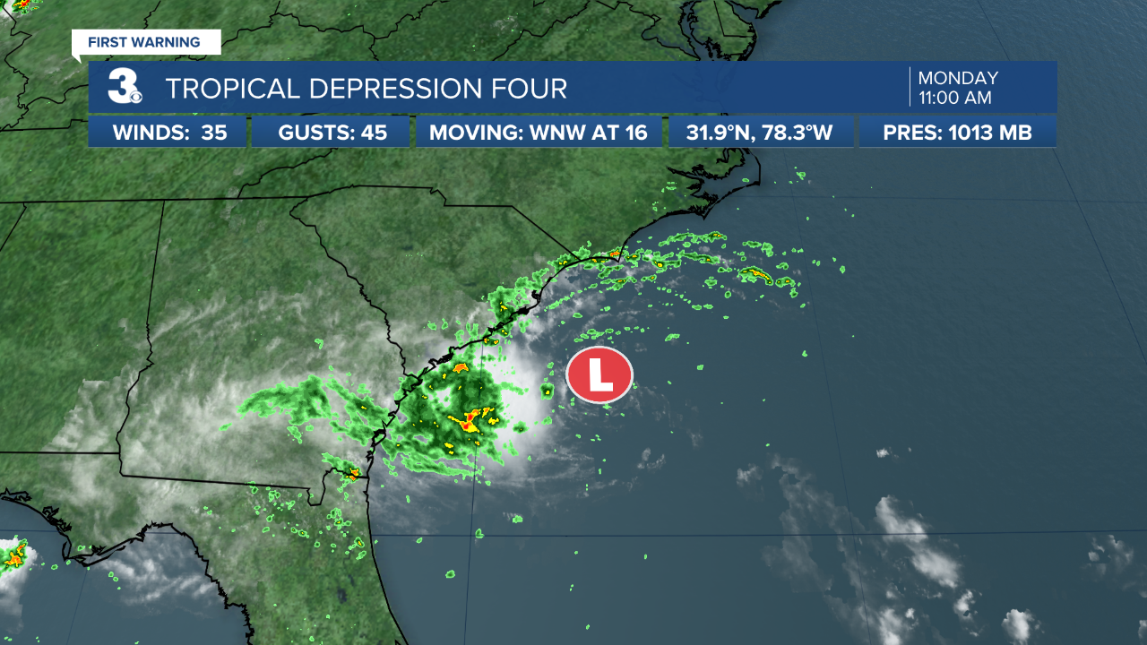
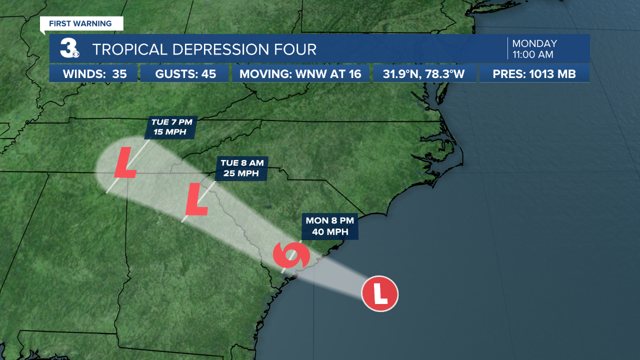
Tropical Depression Four forms off the coast of South Carolina.
Tropical Storm Warning issued for portions of the South Carolina coast.
Located about 145 miles ESE of Beaufort, South Carolina and about 110 miles ESE of Charleston, South Carolina.
Max sustained winds 35 mph
Moving WNW at 16 mph
This general motion is expected to continue for the next couple of days. On the forecast track, the center of the tropical cyclone should make landfall along coast of South Carolina in the warning area later this evening.Some slight strengthening is expected today, and the depression is forecast to become a tropical storm before it makes landfall. Rapid weakening is forecast after landfall occurs.
A broad area of low pressure associated with a tropical wave is producing a small cluster of showers and thunderstorms over the central tropical Atlantic Ocean. Some slow development is possible through the end of the week while this system moves quickly westward to west-northwestward at about 20 mph, likely reaching the Lesser Antilles Wednesday night.
* Formation chance through 48 hours: LOW (20%)
* Formation chance through 5 days: MEDIUM (40%)

Meteorologist April Loveland
For weather updates on Facebook: HERE
Follow me on Twitter: HERE
Follow me on Instagram HERE
Check out the Interactive Radar on WTKR.com: Interactive Radar
