


Meteorologist Kristy Steward's First Warning Forecast
Good Thursday night! Our coastal storm continues to bring us tidal flooding and rough waves as that low pressure system is stuck just offshore in an Omega Block pattern, but soon it will be able to shift a bit south, then back inland. That will bring us less tidal flooding, but also more scattered showers and storms.
As the low starts to shift south tonight and a warm front moves in from the coast, we’ll see isolated to scattered showers start to move in. Overnight lows stay warm in the mid 50s. Northeast winds remain gusty at 15-20 MPH with gusts up to 35 MPH.
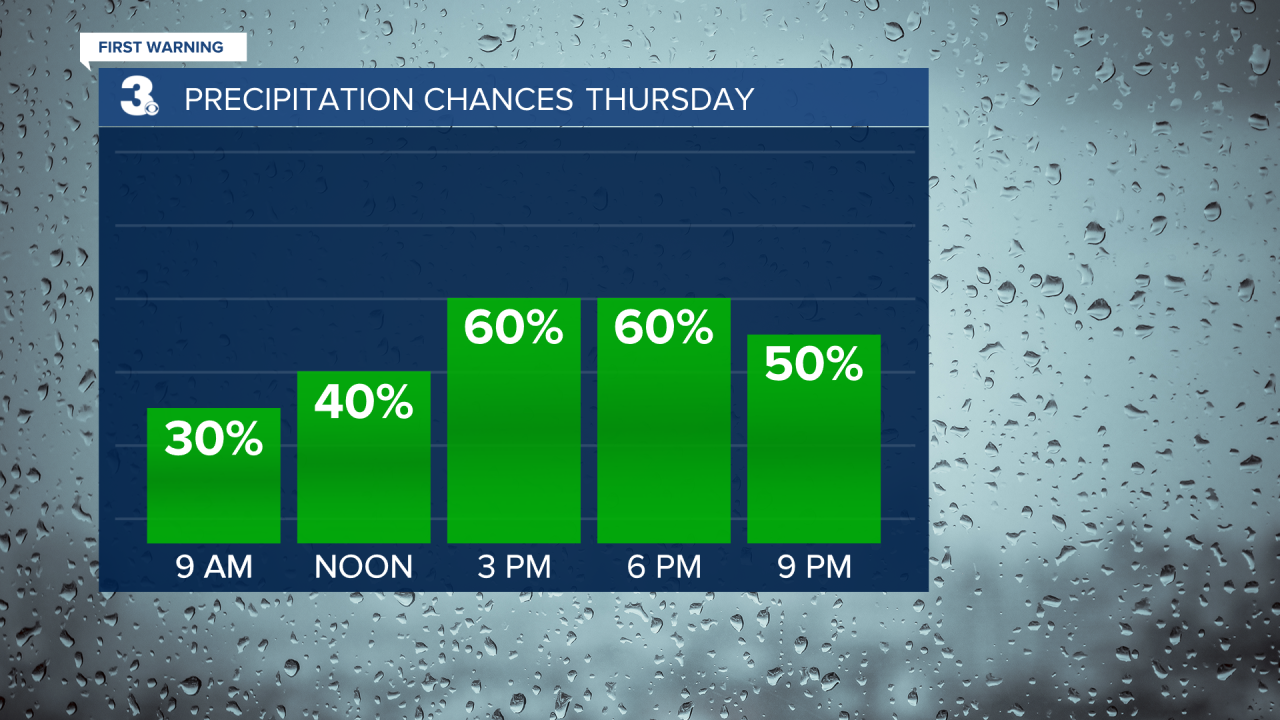
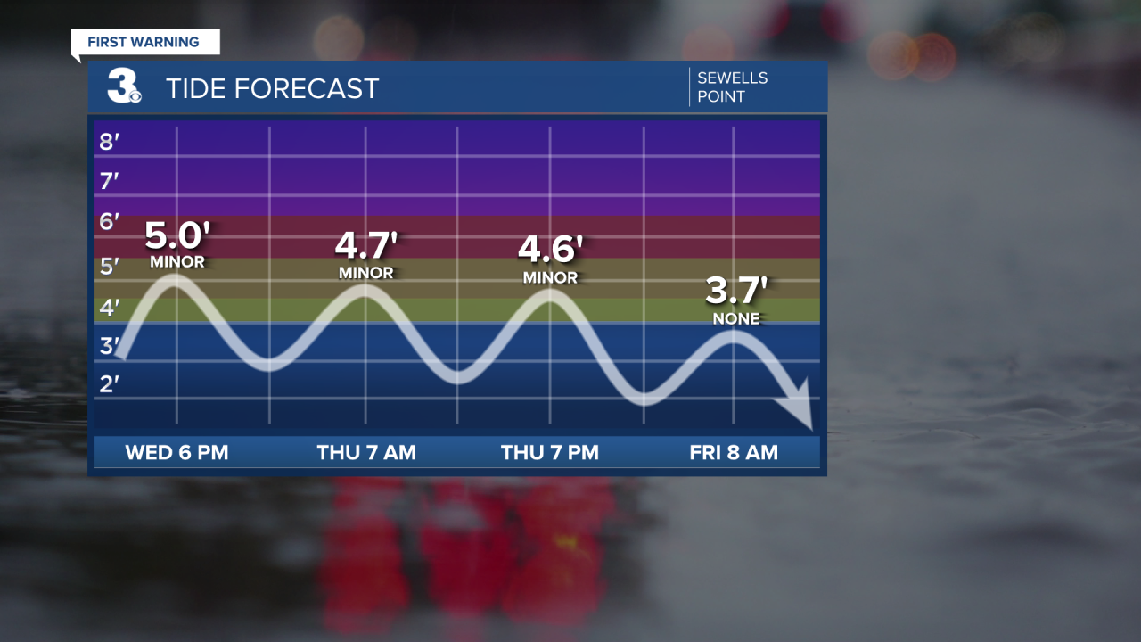
Tidal flooding will start to recede Thursday, but still expect minor flooding during high tide at 7 AM and 7 PM Thursday. High temperatures will be warmer in the mid 60s.
Our warming trend carries into the weekend, but so do the scattered showers and storms. Expect high temperatures in the mid 70s Friday, upper 70s Saturday and low to mid 80s Sunday into Monday.
Finally Sunday, storms become a little more isolated as that low pressure system weakens over South Carolina. However, a cold front Monday night brings us more scattered storms throughout the day Monday.
This cold front gradually cools us down mid-week. Highs in the low 80s Tuesday to the upper 70s Wednesday. We’ll also see lots of sunshine mid-week.
Connect with Meteorologist Kristy Steward:
