


Meteorologist Kristy Steward's First Warning Forecast
Good Wednesday night! Clouds have been building today ahead of a coastal low pressure system that will be bringing us some rain.
As we head throughout the night, rain showers will start moving in from the southwest. While the bulk of the rain and storms will be to our north and west, we'll still have hit-or-miss showers/storms here.
St. Patrick’s Day will start off a little soggy with a round of showers/storms earlier in the morning and another earlier in the afternoon, but we’ll end the day drier with some sunshine. Temperatures will also be mild for your celebrations. Temperatures Thursday morning start in the upper 50s and rise into the mid 60s.

Heading into this weekend, temperatures will climb. Highs in the low to mid 70s Friday reach near 80° Saturday! High pressure quickly passing through late Thursday into Friday will allow us to be mostly dry Friday with sun and clouds. On Saturday, a system will work its way through Hampton Roads. That will bring us scattered showers and thunderstorms Friday night into Saturday morning.
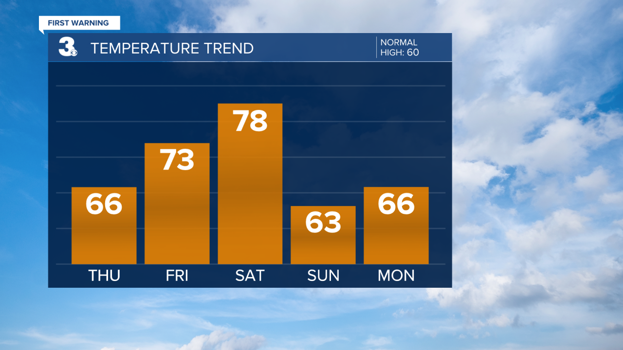
The cold front from that system knocks temperatures back down to the mid 60s Sunday and for the start of next week. Spring starts off dry and partly cloudy on Sunday. Lots of sunshine continues Monday. Another system approaching Wednesday could bring isolated to scattered rain showers for the middle of the week.
Connect with Meteorologist Kristy Steward:
