


Meteorologist Kristy Steward's First Warning Forecast
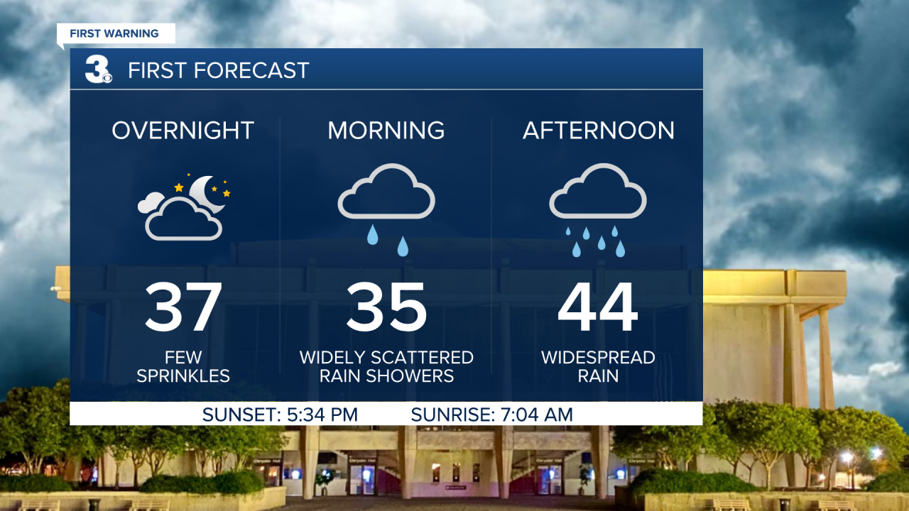
Good Sunday night! We had a couple sprinkles and snowflakes well ahead of an approaching coastal low pressure system today. Those sprinkles will eventually become widespread rain as the low travels along the East Coast Monday.
Tonight expect clouds to continue to increase with a few sprinkles. Temperatures dip down into the mid 30s. Monday morning widely scattered rain showers will become widespread rain blanketing Hampton Roads and northeastern NC by the afternoon. Temperatures only warm a handful of degrees into the mid 40s. Rain showers eventually come to an end Monday night. Just a few lingering sprinkles are possible Tuesday morning.
Clouds clear out later Tuesday and our warming trend carries on. Highs in the upper 40s Tuesday reach the mid 50s Wednesday where we'll stay the rest of the week into next weekend. High pressure will also bring us lots of sunshine the second half of the workweek.
A cold front late Saturday night looks to bring us dropping temperatures throughout the day Sunday as well as scattered rain showers transitioning into snow showers. It's too early to tell if anything will accumulate or not as that largely depends on the timing of the frontal passage and that could change as the week goes on.
Connect with Meteorologist Kristy Steward:
FACEBOOK
TWITTER
INSTAGRAM
