


Meteorologist April Loveland's First Warning Forecast
Showers and storms this evening. Showers will move out overnight. It will be our last 'mild' night for awhile. Lows will fall into the upper 40s and low 50s.
A few lingering showers Wednesday morning, mainly across North Carolina. Temperatures will warm to the mid and upper 50s.
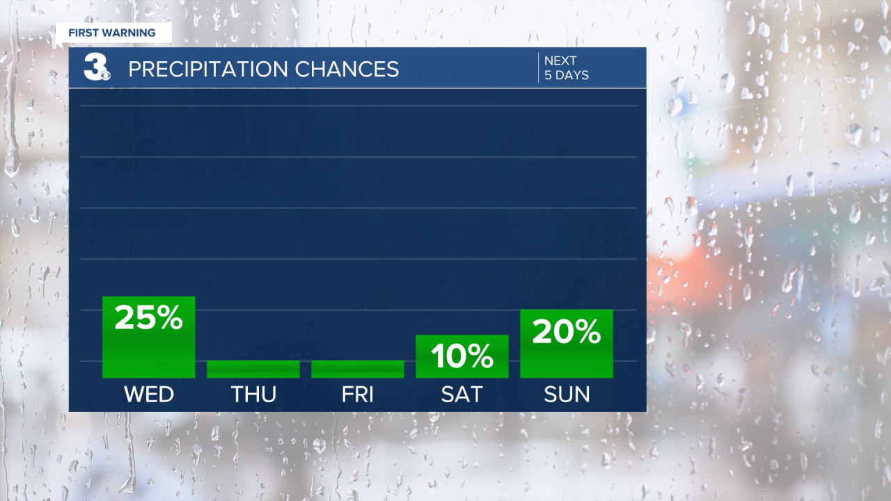
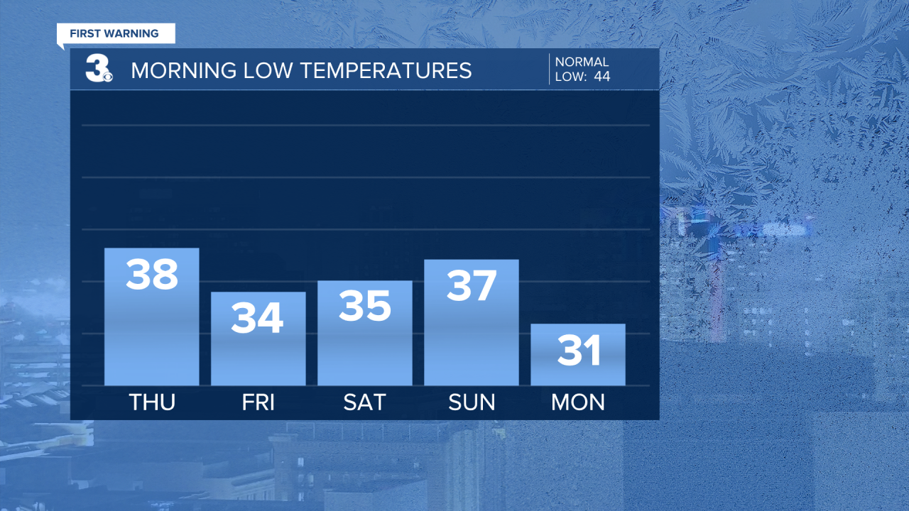
Much cooler heading into Thursday and Friday. Expect clearing skies on Thursday with highs in the upper 50s. More sunshine will break out on Friday with high temperatures near 50.

The weekend is looking cool and dry. Highs will warm to the low 50s both days under partly cloudy skies.
Dry weather will prevail on Monday, but it will be a cold start to the day! Many areas will wake up below the freezing mark. Temperatures will warm to the upper 40s to near 50.
Meteorologist April Loveland
For weather updates on Facebook: HERE
Follow me on Twitter: HERE
Follow me on Instagram HERE
Check out the Interactive Radar on WTKR.com: Interactive Radar
