


Meteorologist Kristy Steward's First Warning Forecast
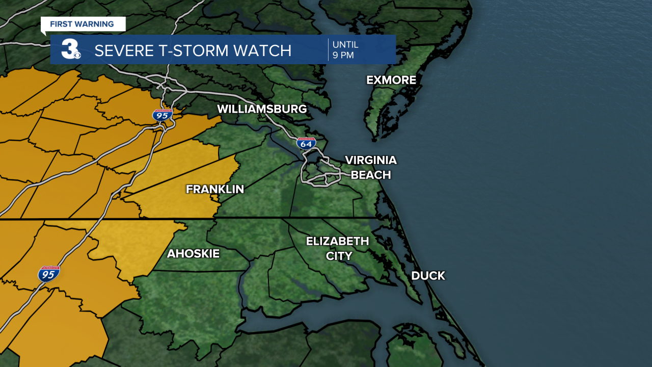
**Severe Thunderstorm Watch is in effect until 9 PM for Northampton (NC), Southampton, Surry, and Franklin. This means conditions are favorable for severe storms to form.**
Good Sunday evening! Strong storms are heading our way now and will impact us as we head throughout the night tonight. This is our first round. More rounds will follow as we head throughout the workweek and stay in this unsettled pattern.
The main threat for severe weather lies within the leading edge of these storms. Scattered storms are starting to enter our inland communities and the Peninsulas now, at 7 PM. By 9 PM these storms will be entering into the 7 cities and by 11 PM the leading edge should be pushing out to sea.
There is a level 2 severe risk for our far inland communities and level 1 risk for most of the area. The main threat is damaging straight-line winds, but small hail and isolated tornadoes can’t be ruled out.

A Severe Thunderstorm Watch is in effect until 9 PM for Northampton (NC), Southampton, Surry, and Franklin. However, all of us have a chance at seeing severe storms this evening.
The main question and wait-and-see factor is how much energy these storms will lose after sunset. If they hold together and don’t lose much energy, we’ll likely see severe storms. If they lose a good amount of energy though, we won’t see any severe storms. Either way, stay weather alert this evening at least until 11 PM.
Throughout the rest of tonight, behind the leading edge of storms, we’ll still have scattered storms persisting through the night. The rain should clear out by sunrise Monday. Areas that see a good amount of rainfall tonight will likely wake up to patchy fog.
High temperatures will be in the low 80s Monday. A few stray showers possible, but much of the day looks dry. Then a cold front Monday evening drops temperatures into the low 70s for Tuesday. Around the front we could have a quick line of showers or storms, mainly across NC. Tuesday evening after 5 PM is when everyone will get the next round of scattered storms. Expect this round to continue until sunrise Wednesday.
Wednesday evening into the night is our third round of scattered storms. These storms have the potential to become strong around a passing cold front. Highs Wednesday in the low 80s again drop to the low 70s Thursday.
We stay in an unsettled pattern Thursday throughout next weekend, but Thursday should be a drier day for us. More scattered storms return Friday afternoon and continue through Saturday. On Saturday, a low pressure system will move across Hampton Roads. Those usually give us storms that need to be watched, so we’ll have to pay attention to the forecast to see what all Saturday could bring. Some lingering showers are possible Sunday, just depending on how quickly that low pressure moves offshore. Behind that system, temperatures do look cooler. Possibly in the upper 60s to end next weekend.

Connect with Meteorologist Kristy Steward:
FACEBOOK
TWITTER
INSTAGRAM
