


Meteorologist Kristy Steward's First Warning Forecast
Happy Wednesday evening! We had a little rain today. A lot more rain is on the way Thursday from a powerful system. The weekend is looking nice.
Tonight stays dry and clouds keep increasing. Lows drop into the low 60s. We warm into the low 70s Thursday. Rain showers start moving in from the south in the morning, but become more scattered with embedded storms by the afternoon. Some thunderstorms could become strong to severe Thursday afternoon and evening. We are under a level 1 of 5 risk for severe storms. Damaging winds are the main concern, but a spin-up tornado can’t be ruled out.


Our coastal communities in northeastern NC, Virginia Beach, and the Eastern Shore are under a Coastal Flood Advisory from 8 PM Thursday until 6 AM Friday. Around one foot of inundation is expected.
We could have a spotty shower Friday, but for the most part we’ll be dry.
This weekend is looking great! Dry with plenty of sunshine. High temperatures will be in the low 70s Friday and Saturday, then flirt with 80° Sunday.
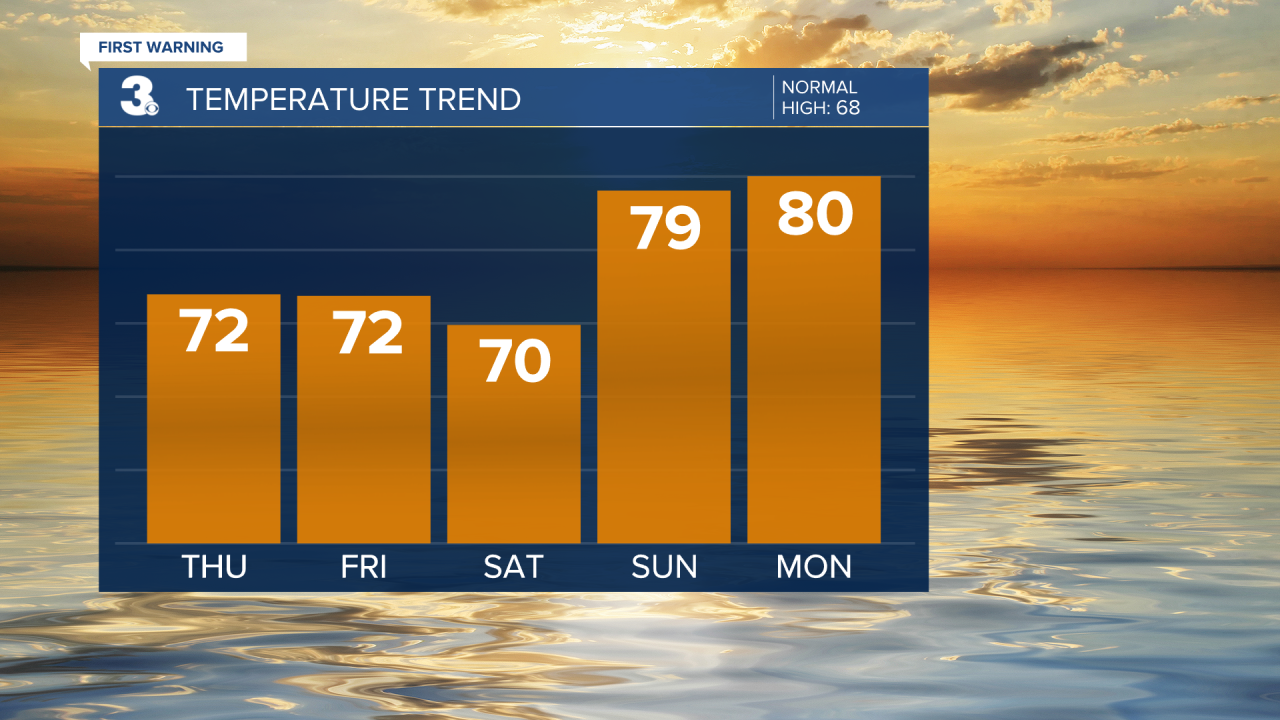
The first half of next week stays dry, partly cloudy, and near 80°.
Connect with Meteorologist Kristy Steward:
FACEBOOK
X
INSTAGRAM
