


First Warning Forecast:
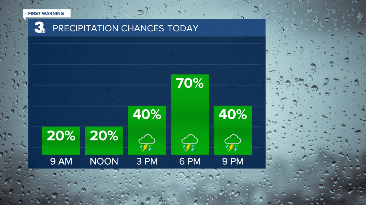
It's been a stormy afternoon. Numerous severe thunderstorms have rolled through the region and we expect another round of storms through 10pm tonight. The threat of severe weather will continue with damaging straight line winds in excess of 70 mph will be possible. Our severe threat and overall storm threat will be over by 11pm.


High pressure will finally make an appearance on Tuesday and Wednesday. Some much needed sunshine will break out across the area. Expect highs near 80. A few more clouds will build in on Wednesday, but it's still looking dry with highs in the mid and upper 70s, which is normal for this time of year. Showers will move in late Wednesday and into the day Thursday as another cold front impacts the area.
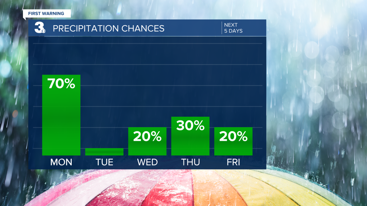
Scattered showers and storms will be possible on Thursday. Temperatures will warm back to the mid 80s.
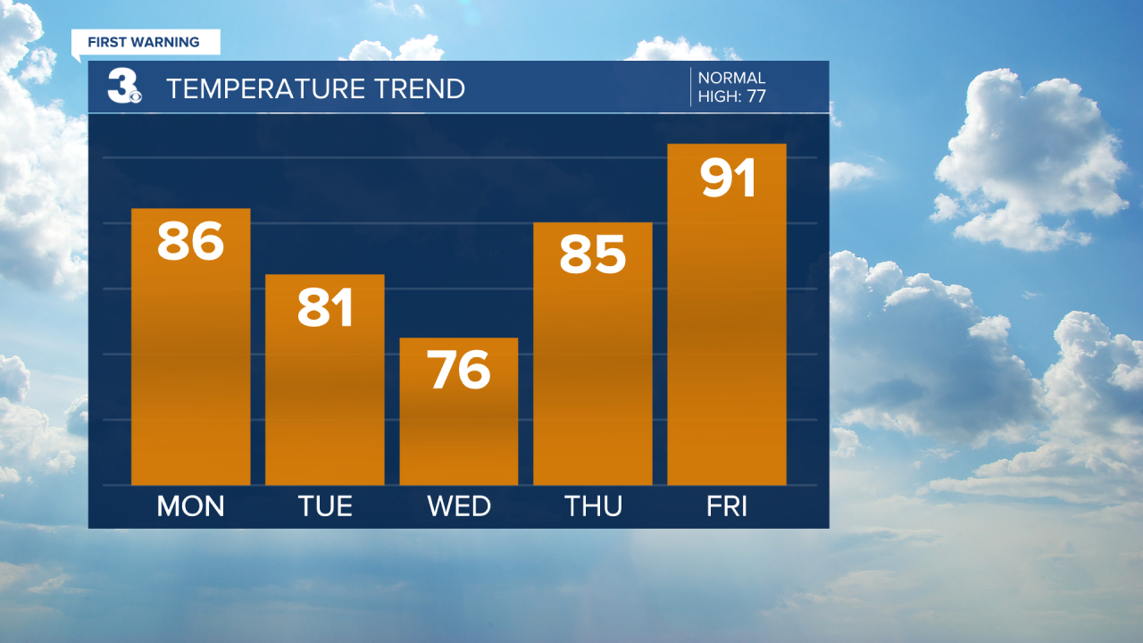
A big warm up to end the week with highs in the low 90s.
Temperatures will continue to trend in the low 90s on Saturday under partly cloudy skies. Cannot rule out an afternoon storm caused by daytime heating.
Better chances for showers and storms by Sunday as another cold front moves in.
